2013 Mulholland Double Century (The staff ride)

4-6-2013:
The Mulholland Double
Century is one of the toughest events on the California Triple Crown calendar.
This would be my 112th California Triple Crown Double.
200 miles with over
16,800 vertical feet of climbing in and around The Santa Monica Mountains of Southern
California.
It was rumored that it
was going to be the last time the event would be held so I did not want to miss
it this year.
This year I opted to
work the ride as part of the staff and do the event as a staff ride. I put
messages out of my intentions and only got one taker to do this awesome ride
with me.
I did the event with
fellow staffer Terri Boykins who is also a Triple Crown Hall of Fame inductee
from a few years back. This was her 63rd California Triple Crown
Double.
We had the awesome
support of my friend Ken Mathis who drove the course carrying all our gear,
food...etc....etc.
We met Ken at the ride
start in Agoura Hills for a 4:30 am
start.
We got off a little
late but we were on our way.
The first leg of the
ride took us down Malibu Canyon Road
to Malibu and PCH where we turned
south for a short run to Topanga Canyon.
From there we went up Topanga to Old Topanga
Canyon before summiting above
Calabasas. The temps were in the low 40’s going through the canyons early, but
clear. As we made it to the top of Old Topanga the weather turned foggy and
misty.
 |
| Terri and I climbing Old Topanga |
 |
| Old Topanga |
Descending Old Topanga
we met up with friend Stefan who rode from home to do some of the ride with us.
He was doing the actual event on the following Saturday. He actually did the whole ride with us from that point where we met to the bottom of Stunt Road where he turned for home.
From there we traveled
on the entire length of Mulholland Highway
to the coast at Leo Carillo
State Beach.
This is a beautiful area to ride and included the infamous Rock Store and the
Rock Store climb which brings you up to the summit above the store.
Making our way down
Mulholland we were met by another friend, Nicole Honda who lives in Agoura. We
all climbed to the summit of Rock Store together. Ken met us at the top and we
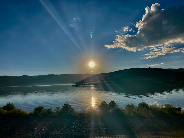
had a nice break with all kinds of good snacks. The sunrise was beautiful with
the fog down in the valleys where we had just traveled.
 |
| Rock Store Grade |
 |
| Stefan and I near the summit of Rock Store Grade |
 |
| Terri and Nicole... Rock Store |
 |
| Ken offering us some nice salty chips after dropping all the fruit...haha! |
A little more climbing and we were at the junction of Decker Canyon and Mulholland for a great descent down to the coast and mile marker 59.5. On the way down I got a front flat tire. Ken and Stefan helped me with it and we were on our way to catch the girls who had gone out ahead.
The temperatures were
just perfect for the climbs that were to come.
North-west we went on
PCH until we reached the Ventura County
line for the start of the first real grunt climb....Yerba
Buena Road. We turned right and there was Ken,
Terri and Nicole. Now we started up the 3.1 mile ascent of Yerba.
Here are some great videos Ken took of Yerba Buena climb:
Here are some great videos Ken took of Yerba Buena climb:
Just when we reached our next turn we got no relief. Now we had to climb Cotharin
Road to the top of Deer Creek overlooking the
pacific. 3.6 miles of up up up.....much around 12% or more. It was a little
warm at this point but not too bad.
 |
| Nicole Honda with Stefan up ahead climbing Cotharin road. |
We then bombed down to
the coast hwy again for a flat section before our next climb, Portrero
Road.
 |
| Terri flying down Deer Creek. If this picture looks familiar, its because just about every car commercial uses this view of Deer Creek! |
We actually had a tail
wind going up the coast which was unusual but I was not complaining one bit.
Once we made it to Portrero
Road, for me the toughest of the climbs on this event,
we just paced ourselves because we knew what was to come.
Stefan went up ahead
to take some pics of us coming up and the girls and I stayed together for the
whole climb. This climb is a grunt. Close to 20% in a couple of places. From a
distance it looks pretty daunting.
 |
| Nicole and Terri looking up ahead where it kicks up real STEEP! You can see it just to the left of that truck. |
 |
| Terri, Nicole and I on Portrero.......Steeeeeep!! |
After summiting we
made a slight descent before climbing the rest of Portero. I would call this part
the easy part of Portrero but it is not real easy just not as steep.
From there we had a
beautiful cruise through Hidden Valley
before returning to Agoura Hills for our lunch stop. We went to a local Subway
sandwich shop on the route and relaxed for about 45 minutes before heading out.
 |
| Hidden Valley |
The course this year
changed some. It was somewhat shorter but had the same or more
climbing than the previous years. The climb up Balcom
Canyon near Santa
Paula was left out.
Instead we went up Kanan
Road and over the hill into Moorpark before
descending Norwegian Grade and Santa Rosa Road
to Camarillo.
As soon as we turned
onto Santa Rosa Road we had
headwinds. The winds got stronger and stronger and peaked as we got closer to
the coast. Nicole had left before lunch to go home so we had three people to
work together in the wind. We just hunkered down and trudged into it averaging
anywhere from 13-16 mph. For me this was the hardest part. Head winds kind of
take the life out of you.
Onto PCH we went again
and now.....guess what? We had a
blasting tail wind to blow us to the start of some more massive climbs.
 |
| Tail winds.....tail winds....yes!! |
We made it to Decker
Canyon a little after 5 pm which was really good.
Up we went on this
very tough climb. 3.7 miles with some sections at 17% but most of it close to
10% and above.
 |
| Here we come up Decker. Thanks for another great shot Ken!! |
Here is a video of me finally catching up with Terri at the middle of the Decker climb. Not as steep as the above section from the coast but still plenty-o-GRUNT!! Boy she was climbing like a woman possessed!
We stopped at the fire station for a break and I changed my base layer to a thin wool since it was getting cool and I was just drenched with sweat.
Our next climb was
upper Encinal Canyon.
3.5 miles with a nice descent to start but then a long steady 9% or so to the
summit at Mulholland near the Malibu Winery.
Now we got to descend
the Rock Store grade. I got the chills from the cool air on the way down so I
had to slow way down.
We rolled along the
highway now for some minor climbs before crossing Malibu
Canyon and making our way to the
final climbs of the event, Piuma Road
and Shueren Road.
There was still a little bit of light when we started to climb 5.7 mile Piuma but it was mostly dark.
There was still a little bit of light when we started to climb 5.7 mile Piuma but it was mostly dark.
Here we are climbing Mulholland just before Cold Creek. Scary sounds coming from that car:
Here are the videos Ken took on the climb up Piuma Road in the dark. Really cool Ken!!
Cruising up Piuma Road with Ken doing some cool effects with the lights:
Here are the videos Ken took on the climb up Piuma Road in the dark. Really cool Ken!!
Cruising up Piuma Road with Ken doing some cool effects with the lights:
At over 172 miles and with a considerable amount of climbing in the legs already and about 1/2 way up Piuma, one of my favorite Jeff Beck songs, really got me motivated as this video will show:
We all kind of climbed it at our own pace before meeting up at Stunt road
for a breather.
It was so chilly
descending Stunt as usual that we had to ride our brakes and pedal just to keep
our motor running so as not to get the chills. As soon as we got to the bottom
of Stunt, Stefan headed home from there and Terri and I just cranked it back to
the finish feeling much better. There were a few little climbs in the Agoura
area getting to the finish but they were nothing compared to what we had just
done.
What an awesome ride.
We both felt great at the finish.
On this event I just
paced myself like I did at the Joshua Tree event and I felt great the whole
time. My average heart rate on each loop was in the 120’s which is low for me
so I knew I was doing good. I usually am in the upper 130’s to mid 140’s.
Thanks Terri, Nicole
and Stefan for the company.
Last but the most
important of all......Thanks to the awesome Ken Mathis for supporting us and
making it possible for all of us to have such a great time. Thanks Ken for the awesome pictures and videos also!!
First loop: http://connect.garmin.com/activity/294664716
Second loop: http://connect.garmin.com/activity/294664547
Second loop: http://connect.garmin.com/activity/294664547
Course Map: http://ridewithgps.com/routes/2298866
Note: elevation gain is not as much as shown on this site.
All the pictures can be viewed HERE
Note: elevation gain is not as much as shown on this site.
All the pictures can be viewed HERE

.jpg)
Comments
Post a Comment