Mulholland Challenge 2016 (New Course Staff Test-ride)


A little prelude to the ride report:
This year The Planet
Ultra Mulholland Challenge century and double century is a whole new
course.
The KOM (King of the Mountains) course was shortened some
but included more climbing which made for an even more difficult century.
I had my hand in the mapping of the second half of the
double century.
Debra of Planet Ultra asked for my assistance in mapping the
new course since I live and ride the roads in the area all the time.
We, together, made up, in my opinion, an epic course for the double and
the single century event.
For those who read
this ride report prior to the event, I hope it helps you prepare for this very
difficult event.
We made up the new course long before the event which is
scheduled for the 9th of April.
I organized a pre-ride of the course so we could get feedback on the new course and sent out a message to many of my friends and asked if they
would like to join me.
The test ride was scheduled for February 27.
Again as in past years, my friends Nicole and Hal graciously
volunteered their house for our starting location and opened it up for us to
relax at the half-way point of the double which is also the finish of the century
(on the staff ride). The actual event starts and finishes at the Sheraton Agoura Hills.
They even had pizza and spaghetti and meatballs for the double century riders at the end, in the wee hours.
They even had pizza and spaghetti and meatballs for the double century riders at the end, in the wee hours.
(The house is a
couple miles from the actual event hotel so the mileage is virtually the same
as the event.)
Thanks Nicole and Hal!!
We had a group of 13 riders start at 4:50am. Some were just
doing the King of the Mountains Century Challenge and a few of us, myself
included, were planning on pre-riding the double century course.
Planning to do the century were some of my Adobo Velo
brothers and sisters, Jerold, Beto, Celine and Rosalie. Also doing the century
were my friends Julie, Nicolette and Ellen. On the fence and playing it by ear
as far as the double were Terri and Daniel. They wanted to see how they felt at
the half-way point.
Committed to the double were Keith, Quynh and Tony.
(Tony was doing it on a fixed gear bike….OMG!!!)
A group of 4 very strong riders, David, Judy, Pete and Jeff,
started a little after 6am and were planning on riding the whole thing
self-supported. We had some support for the century later in the morning.
The last two years, I did this double century staff ride on
my tandem with my ultra-stoker Teresa. Both years were epic and difficult rides
on my tandem with many bike problems not to mention doing 17,000 plus feet on
the tandem. (You can read those stories in my previous ride reports)
With about 13,000 feet of elevation gain in the first 106
miles of this event, it was very difficult to map the second half without
making it a ride with over 21,000 feet of elevation gain. I had to put some
flat recovery miles in there somewhere. I finally came up with a great option
which is one of my training rides I have done over the years although I do it
from my house in the San Fernando Valley.
It encompassed climbing Westlake Blvd after the halfway
point back to Mulholland and to the top of Latigo Canyon before descending to
the coast for a nice long recovery ride northbound along the coast. It then
takes you through the farmland of Camarillo and Moorpark before climbing back
to Hidden Valley via upper Potrero Road to the finish in Agoura.
198 or so miles with 18,600 feet of elevation gain is what I
came up with. 15,700 feet of elevation gain in the first 125 miles or so. This
ride is a climbers dream. I just hope that people won’t be so mentally
shot after the first century that they don’t go out for one of the most
beautiful parts, the climb to the coast in the late afternoon so they can
experience the beautiful sunset along the coast.
 |
| Getting ready to roll. From the left: Rosalie, Beto, Celine, Jerold, Keith, Me, Quynh, Ellen, Daniel, Terri, Tony and Nicolette. |
Part one:
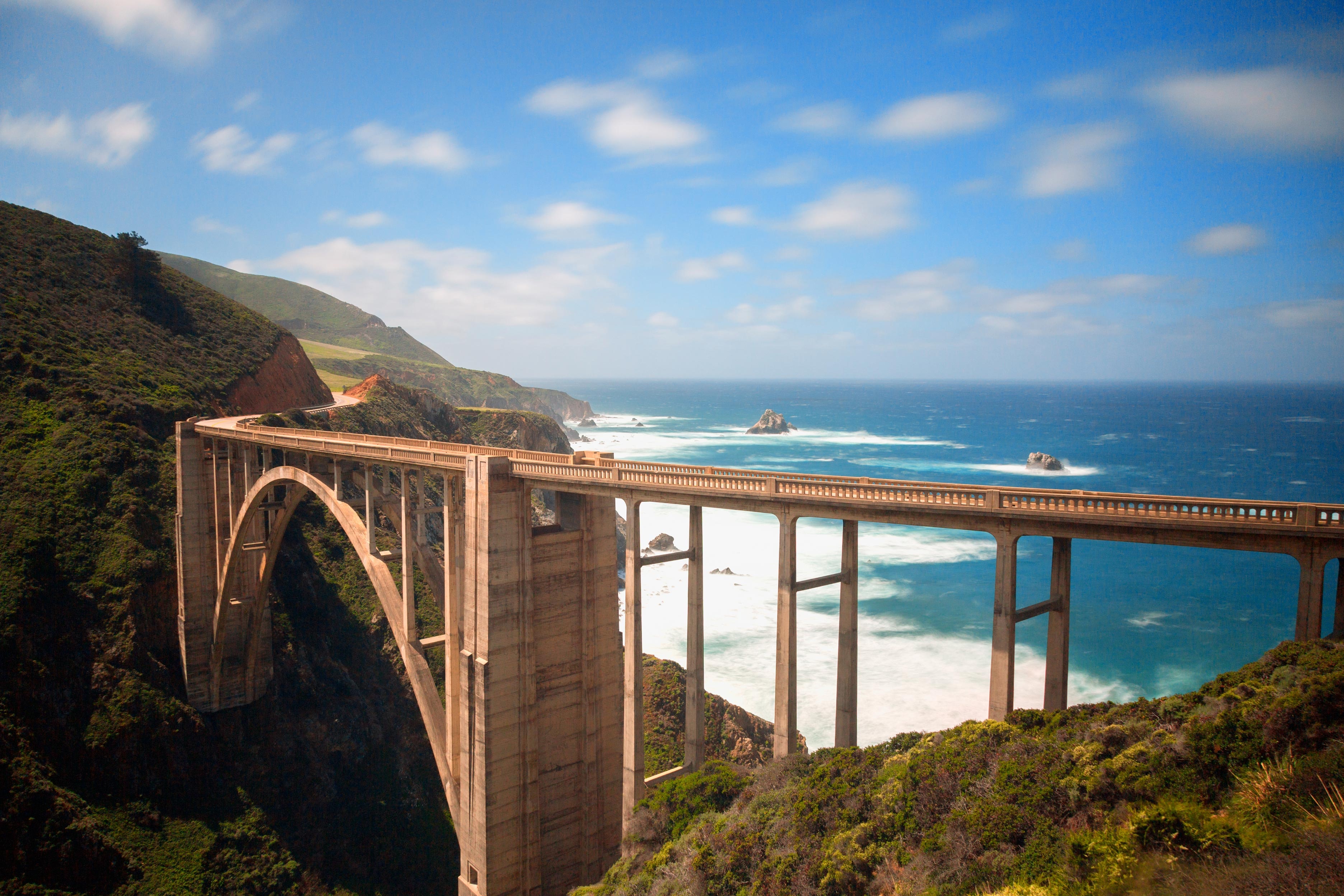
Mulholland South, Topanga Canyon, Old Topanga Canyon, Stunt Road and Piuma South-side ascent and north-side descent. Cold Creek road to Mulholland. Mile 0-46
Mulholland South, Topanga Canyon, Old Topanga Canyon, Stunt Road and Piuma South-side ascent and north-side descent. Cold Creek road to Mulholland. Mile 0-46


It was chilly and in the mid 40’s when we started in Agoura Hills. We rolled over to Mulholland Hwy via Cornell Road. It got colder and colder as we approached the intersection of Mulholland and Las Virgines. It was 34 degrees on the descent to the junction and we were glad we had a climb coming.
It was, again, a magical morning up there. It really reminded me why I love to train in the wee hours of the morning up there. It is so beautiful at first light that you become addicted to it.
On the old course we used to turn
right at this junction and descend to the coast before heading south on PCH to
Topanga Canyon. We would then climb the canyon from the south to Old Topanga.
This year we went straight on Mulholland which was much nicer than that section
on the coast.
 |
| Rolling up Mulholland |
Up Mulholland we went and it got a
little warmer by the time we reached the top of 7 minute hill before dropping
to Calabasas. We took a long break here and re-grouped.
Now we descended down to
Mulholland Drive before turning right to climb Topanga Cyn from the north side,
a fairly easy climb. It was just starting to get light and looked like it was
going to be a beautiful day.
 |
| Daniel looking good and warm |
It was warm at the top but the
temperature dropped about 15 degrees by the time we reached Old Topanga down in
the canyon. Now for another long and beautiful climb, one of my favorite local
climbs. There are a few good kicker sections of this climb as you are nestled
among beautiful oak trees and a beautiful creek bed. The sun rose on this
section and it was great and warming nicely. We had a great descent back down
to Mulholland where we made a left turn and back tracked now for our next
climb, the infamous, Stunt Road.
Up and over “the wall” in
Calabasas, we went before the long descent to Stunt.
 |
| Nicolette climbing Stunt Road |
 |
| Daniel on Stunt |
Stunt road is about 4 miles with
1,400 feet of elevation gain. It takes you up to the Saddle Peak area. There is a water fountain on the right in a
driveway the homeowner put in for cyclists. We stopped there to fill up with
fluids.
There are spectacular views of the
Santa Monica bay and Catalina Island for up there.
 |
| Saddle Peak view of Santa Monica bay on a different day |
 |
| Looking down at Malibu |
We did a small re-group up here
but riders of different abilities were already starting to spread out.
We now rolled down Schueren Road
to do our next climb. Piuma Road…..south side.
More epic views on this short
climb as we again looked down at Malibu and the Santa Monica Bay.
Over the top we went for the
amazing descent down the North side of Piuma. This is one of my favorite climbs
coming up from the Malibu Canyon area. This road was the final climb on the Double
Century on the old course and is a real beast to do at the end.
I took a video of this descent and here it is for your enjoyment:
We made a right turn onto Cold
Canyon for yet another climb. This one is very steep for a short period near
the top. About 16%.
Next up, Mulholland Hwy all the
way to the coast including the infamous Rock Store Climb.

 |
| This is the map and profile of this section for the actual event. (The road was closed on the staff ride so we took a slightly alternate route but the elevation and distance were virtually the same). |
After our left turn on to Mulholland
Hwy we had a nice gradual descent down to Malibu Canyon where we crossed Las
Virgines road and started climbing again.
 |
| Terri climbing at Malibu Creek State Park |
We climbed above Malibu Creek
State Park, backtracking our course from earlier in the morning where we all
braved the cold. The temps were now perfect for climbing as we rolled passed
Malibu
Lake and Peter Strauss Ranch where the checkpoint usually is on event day.
Lake and Peter Strauss Ranch where the checkpoint usually is on event day.
Next up…….the infamous Rock Store
Climb.
We passed the famous “Rock Store”
on our left and started the climb. At this point we all stopped to fix a flat
tire and our SAG support showed up with perfect timing with Cokes and support.
Some of the rest of the group caught up also. The 4 late fast riders, David,
Pete, Judy and Jeff, passed us at this point. They looked like they were
pushing pretty hard.
 |
| Nikki's tire is fixed and we are ready to roll |
We now started up the Rock Store.
This is a really popular climb for cyclists and motorcyclists alike. The people
on the motor bikes can be a real pain though because they are always racing up
and down the climb.
I rolled up with my friend Tony.
He was doing the double century on his fixed gear bike. This is just amazing to
watch. He keeps telling me its not that hard once you get used to it but is
just looks painful! Here is a video of Tony climbing Rock Store on his fixie!!
We slowly paced ourselves to the
top where we took a break and re-grouped with the SAG vehicle. I was asking
people if they knew if Mulholland was still closed where the brush fire was and
no one knew. We would alter our course slightly if it was.
We continued the beautiful ride on
Mulholland, past the winery. We passed the camel farm on the right but did not
stop this year. When we reached the junction of Mulholland and Westlake Blvd.
we waited to ask people if the road was still closed down below. Some cyclists
came up and said they went down and were turned around.
We took the detour option down
Decker Canyon to the coast instead of taking Mulholland down. This added about
200 feet of elevation gain to our ride but the mileage was 3 tenths of a mile
less. (Almost a wash)
We got to PCH where we ran into my
friend Quynh who had gone up ahead of us on Rock Store. A cyclist told him that
Mulholland was open so he descended it, only to be turned back by the CHP so he
had to do 5 bonus miles back up the hill to get back to Decker Canyon. He had
just gotten to PCH when we got there.
We rolled up the coast to our next
turn, Yerba Buena Road. This is right at the start of Ventura County and next
to Neptune’s Net restaurant. It is a really a popular place along PCH.
Part 3:
Yerba Buena to Cotharin Road and Pacific View. Deer Creek descent with PCH southbound to Decker Canyon. Mile 72.3 - 87.3
Yerba Buena to Cotharin Road and Pacific View. Deer Creek descent with PCH southbound to Decker Canyon. Mile 72.3 - 87.3


The climbs keep getting
progressively tougher on this first century of the double. We now climbed up Yerba
Buena which is a canyon climb with not much of a view. The mountains up ahead
look beautiful but are nothing compared to what is ahead.
Arguably the most beautiful view in the Santa Monica Mountain are Cotharin Road, Pacific View and Deer Creek roads.
Arguably the most beautiful view in the Santa Monica Mountain are Cotharin Road, Pacific View and Deer Creek roads.
From Yerba Buena we made a left
turn on Cotharin Road. This was a tough one. 18% is what my Garmin was telling
me in a few sections and 10-12% on much of the rest to Pacific View.
Here is a video of some of our
group climbing one of the 18% sections on Cotharin. Check out Tony on his fixed
gear bike. All I can say is…….dude…….that is amazing!!!
There is a spectacular view of the
ridge from this road before rolling up to Pacific View. This is also where the giant ice cream cone is and the airplane house which you may have heard of on the news. I didn't see them though.
Daniel, Nicolette, Quynh and I rolled over the top and down Deer Creek on this spectacular day. We stopped to take some pictures and rest our hands from the breaking on this section.
Daniel, Nicolette, Quynh and I rolled over the top and down Deer Creek on this spectacular day. We stopped to take some pictures and rest our hands from the breaking on this section.
Here are a few pictures and a
video of the area.
Deer Creek is a dangerous descent
of about 11%. You are on the brakes the whole time because it is scary fast.
This is where I destroyed my rear wheel on the 2014 staff ride when I
overheated the rear wheel on my tandem causing the tire to explode. We finished
the ride with about 5 hours off the bike thanks to help from our fellow rides.
(You can read that story if you want in 2014 event post)
This is not a descent for the foolhardy and many with carbon wheel-sets have had their wheels fail on this dive to the ocean!!!
This is not a descent for the foolhardy and many with carbon wheel-sets have had their wheels fail on this dive to the ocean!!!
 |
| Nikki on Pacific View almost to Deer Creek summit |
 |
| Quynh and Nicolette on Deer Creek |
Here is a video taken from one of the vantage points with Quynh and Nikki coming down. Check out the parasailer who dove over us.
After this amazing and beautiful
descent we made a left turn on PCH for a nice southbound cruise to Decker
Canyon for a real beast of a climb.
Part 4:
PCH to Agoura Hills. Finish of the Challenge Century (staff ride) Mile: 87.3 - 105.4
PCH to Agoura Hills. Finish of the Challenge Century (staff ride) Mile: 87.3 - 105.4


Now came the toughest climb for
all of us. The climb up Decker Canyon from the coast is steep and long. It is
usually hot too. This climb came at approx. 160 miles into the old double
century course and is much easier when doing it with fewer miles in the legs
but very tough non the less.
We rolled slowly up the lower
steep section before the big switch back where there is a little bit of a
breather section to catch your breath. It then kicks up again big time and just
when you think it is going to level a little, it starts to kick up again. This
climb pretty much finishes at the Decker Canyon Fire Station. We stopped here
for water, to eat and re-group some. Nicolette, Quynh and I re-grouped here.
Tony, Daniel and Ellen were at the bottom starting up about when we got there
and my friends in the Adobo Velo crew were on the climb up Yerba Buena and
Cotharin.
Next climb……upper Encinal Canyon
to Mulholland.
This climb really is hard. It
starts off with a nice descent from Decker but then you have to climb out of
the canyon you dive into. It is not particularly steep, it is just straight and
one of those that doesn’t quit until you get to the top.
We reached Mulholland and now
came an A ticket ride.
We descended Mulholland past the
winery and down the Rock Store descent. This is an epic descent with many
twists and turns before reaching the bottom.
We passed Peter Strauss Ranch
again. (This is usually a check point on the event but with the course change
this year, I am not sure if this will be the location.)
The course now takes a right turn
on Lake Vista Drive. This is a beautiful detour off of Mulholland and brings us
around Malibu Lake. We re- join the course on Cornell road back to the finish of the Century
event.
We rolled into Agoura hills around
3pm completing one of the toughest century courses around.
Nicolette, Terri, Ellen, Daniel,
Julie, Rosalie, Beto, Jerold and Celine were done and tired. Nicolette, Terri
and Daniel decided to stick with the century and called it an epic day in the
saddle. That 100 miles is tougher than many double century rides! A big
congrats to that crew!!


After taking a long break at
Nicole’s house and stuffing our faces, Tony, Quynh and I set out to finish the
new double century course. The faster riders, Judy, David, Jeff, Pete and Keith
were on their way for the second half.
This is the part of the course
that I mapped to try and turn this tough event into a double century. The
second half of the event on the actual event day will be done Brevet style
which means that you will be basically self-supported. There are plenty of
places to stop for supplies and water along this final section once you are
over the mountains and on the coast.
Personal support vehicles are encouraged and
will be allowed on this second half of the course during the event I believe. I
believe they must offer support to others if needed.
Our friend Ellen who did the
century ride, graciously offered to be our support for this second half of the
double century after she rested up a bit at the hotel and cleaned up while we
were climbing to the coast.
From Agoura Hills we spinned
quickly though Westlake before climbing the North side of
Westlake Blvd. This is the road that eventually becomes Decker Canyon. We were
now climbing over the North side of it.
Westlake starts out with a gradual
climb before kicking up to 17% on the wall that just kicks butt. It then
flattens to 8% with some 10% sections before the left turn on Mulholland.
It was a grunt on that climb but
felt good after a long break and a nice warm-up getting there. I got to the top
and waited for Tony and Quynh. They arrived shortly after I got there.
We now made the left turn getting
back on Mulholland once again.
Keep your eyes out to the left a little less than a mile down the road if you want to see our friends the camels!!
Keep your eyes out to the left a little less than a mile down the road if you want to see our friends the camels!!
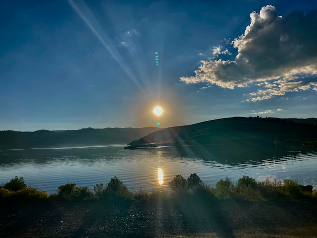
This little section of Mulholland
was really beautiful at this time of day. The sun was beginning to set and the
sky was beautiful. We descended down to Kanan Road where we made a right turn.
It was about ½ mile to our turn on
Latigo Canyon. The climb up the north side of Latigo was beautiful. Tony was
commenting on the sound of the crickets and frogs as we climbed to the first
summit of Latigo.
 |
| Looking down Latigo Canyon from above with Santa Monica Bay below. People who reach the top before dark will get this amazing view. |
The Latigo Canyon climb from the
coast is one of the best climbs in the area. It is one of those great climbs
with many switch-backs and false summits. On the way down from the summit, it
is a long descent with a little climb in the middle to get over one of the
false summits.
It was still warm at the top but
as we dropped into the canyon the temperature dropped about 15 degrees in a few
places and I started getting the shakes. Then it warmed up again when we got to
the coast so I didn’t need to put my leggings and jacket on just yet.
Part 6:
The easy recovery, (It seemed like one to this veteran), section and the final climbs and the finish. Mile: 130.3 - 198.8
The easy recovery, (It seemed like one to this veteran), section and the final climbs and the finish. Mile: 130.3 - 198.8


We rolled northbound now on
Pacific Coast Hwy on the coastal roller hills. Ellen caught up to us shortly
after we got on PCH and we made a stop at Zuma Beach to put on our leg covers
and jackets. It was starting to get chilly and you just get colder with that
many miles in your legs. She brought us a whole giant bag of Arby’s roast beef
sandwiches. Oh that was a good rest stop……..thanks Ellen!!
We now felt great heading up the
coast past the area where we had been earlier in the day, Deer Creek and Yerba
Buena. I made a suggestion to Tony that maybe we should detour up Deer Creek
for a little extracurricular climbing and he just grumbled as he spun his fixed
gear to my rear…..haha!!
We really cruised this section up
the coast at a good pace until we came to the naval air station. We then took a
little break before heading over to Hueneme Road and our turn north-east bound
toward Moorpark.
We rolled in the night through the
farmland of Camarillo and Moorpark on Lewis Road and Santa Rosa road. These
roads were as smooth as a baby’s bottom until we reached the upper part of
Santa Rosa road.
There are some rumble strips in
this section which are not usually a problem when I am out training but on this
day, apparently, there must have been some work going on in the area because
there was a lot of gravel we had to avoid in a few areas. ( I am going to go out and check this out prior to event day since I live fairly close and bring my broom just in case.)
There was a little more traffic than usual heading to Moorpark because I think some sort of event was getting out somewhere. (On event day for those doing the double century, this area should be ridden with some caution in the dark. There is plenty of shoulder to the right of the rumble strips but be careful of any gravel in the road. )
There was a little more traffic than usual heading to Moorpark because I think some sort of event was getting out somewhere. (On event day for those doing the double century, this area should be ridden with some caution in the dark. There is plenty of shoulder to the right of the rumble strips but be careful of any gravel in the road. )
We made it up the minor hill to
Moorpark for the next real climb on the event, Old Norwegian Grade. This is a
short climb but has a lot of history. Check out the embedded flashing lights in
the pavement warning drivers of the curve coming near the top. It’s pretty cool
and we hadn’t ever seen anything like that before on any of our events. We were sure that we were seeing other cyclists up ahead with their flashing tail lights.
Over Norwegian Grade we went and
we made a right turn on Olsen Road for a nice gradual descent through the town of
Thousand Oaks. This grade has historical significance as the settlers of the area built it. Read the hyperlink. Very interesting.
Olsen Road became Lynn Road as we
cruised into Newbury Park for some more rolling hills before our final climb.
This area has plenty of places to stop for those doing the double century event
self-supported.
Now for the final climb.
Many people remember the climb on
Potrero Road at The Grand Tour Highland Double Century. I usually captain the
check-point on this ride.
On the Mulholland Double we do not
do the lower, steep, section of Potrero Road.
We made a left turn on Reino Road
which took us to the upper section of Potrero where the Grand Tour check-point
is.
We climbed this final climb into
Hidden Valley, rolled through the chilly valley and made the turn on Lake
Sherwood drive. (There is a water stop at the fire station here).
Around the lake we went before
hitting Westlake Blvd. once again and rolling through town a short distance
to the finish at Nicole’s house.
When we arrived, Nicole and Hal
had Costco Pizza for us and spaghetti and meat balls!
We rolled in after midnight after
a long day in the saddle. It was an epic climbing day but Tony, Quynh and I did
not really push the pace very hard all day.
The fast double crew had finished
a couple hours before us.
An epic day in the saddle on a
great course.
I think this course would be great
to have on the Triple Crown Stage Race one of these years.
Congrats to all my friends who
finished this tough century course.
Congrats to all those who finished
the pre-ride of the double course. What a day in the saddle.
Thanks to Nicolette’s husband and
son for giving us support on Mulholland and the coast in the morning.
Thanks to Nicole and Hal of course
for offering their place to do the ride from and relax after. (Hope you didn’t
get too many complaints from the neighbors.)
Thank you Ellen for the awesome
SAG support on the final section of the double century. We had a great time
didn’t we?
I really hope that there are more people who sign up for the Double Century option this year. It is a great course and very challenging for those who love a challenge. It is not for the faint at heart though since there is 15,600 feet of climbing in the first 120 miles of the ride. All that said......if you fuel properly and are prepared.....you will recover when you roll up the coast on this section before the final climbs to the finish.
I personally would love to keep this double on the schedule. Its amazing!!
Thanks to Planet Ultra for accepting my double century course option for the test ride. I hope everyone likes it.
Here is the compilation video of the entire ride:

Comments
Post a Comment