
We all got together for the staff ride at Nicole Honda's house in Agoura Hills a short distance from the regular ride start and right on the course. We all met at 4
 |
| The bike is ready to roll |

Part One: Mile 0 to mile marker 43....Peter Strauss Ranch
The first part of the event is an easy roll to the coast with a few rollers. I was on the tandem this year again with Teresa Beck. We wanted a re-do of last years ride where we had the rear wheel explode on Deer Creek descent.
The first part of the event is an easy roll to the coast with a few rollers. I was on the tandem this year again with Teresa Beck. We wanted a re-do of last years ride where we had the rear wheel explode on Deer Creek descent.
Along with us we had Terri Boykins, Julie Stokes, John
Clare, Jeff Dewey and Rob Kelly. Julies husband Colin Stokes was on his own
training ride and was riding with us at certain points in the ride.
 |
| Lit up pretty well while rolling up Malibu Canyon Photo by John Clare |
We negotiated the first few hills out of town for a nice
stroll through Malibu
Canyon
We rolled up PCH south bound toTopanga Canyon Mulholland
Hwy for a long trek to the coast again.
We rolled up PCH south bound to
It was beautiful on this spring day. There were yellow wild
flowers everywhere and perfect temps for climbing. We climbed away from Malibu Canyon Malibu Lake
 |
| Climbing on Mulholland in Calabasas Photo by John Clare |
 |
| Yellow everywhere |

Part Two: Mile 43 Peter Strauss to Neptune ’s
Net and Yerba Buena Road .
Mile 61.2
Now it was time to get serious about the climbing. First
major climb of the day......Rock Store. The Rock Store climb is famous among
cyclists, motor cyclists and race car aficionados. It snakes up from the famous
“Rock Store” restaurant and store to a beautiful summit we like to call The
Crows Nest.
I have to mention that we already had a problem with the tandem from
the last ride we had to deal with on this one. The front derailleur would not
go into the big chain ring at any cost and I didn't have the time or money to
get it fixed in time. I took it to the shop and they could only get me the
granny gear and the middle ring. Luckily, this event was mostly climbing but it
was a real pain having to coast on all the gradual descents because I had no
high gears. It really slowed us down on the flat parts of the course and in the
tail winds. We were “spun-out” at 26 mph in the middle gear.
This year it seemed tougher climbing up Rock Store. Last
year we were both in better shape at this point in the season I think. It still
did not seem too tough though and we made it over the top fine. One more little
climb was negotiated past Malibu Wines and we started the mostly downhill 10
mile descent to the coast at Leo
Carrillo State
Beach
We first rolled past the camel farm. Here are a few pics of
the camels I took on other rides.


The descent was really nice and smooth but again I had to
coast the whole thing.
We rolled for a stop along the coast at the Neptune ’s Net Restaurant for a water stop and break
before the real climbing began.

Part Three: Mile 64.3 to lunch at mile 102.
Yerba Buena, Cotharin and to the bottom of the infamous Deer Creek Road
were up next.
This was one of the longest and toughest climb sections. We
put the bike in an easy low gear and just spun our legs on Yerba Buena. This
climb averages I think about 7% but there are sections that are around 10% I
think. It is a long slog to our turn on Cotharin.
About half way up and after all our strong climbers had left
us up ahead, something freaky happened again. (What is with the tandem jinx on
this ride?)
We were climbing in our lowest gear and.......BAM......the
chain snapped!!!
I thought our day was done just like I did last year after
the tire melt down.
The chain didn't break;
it came apart at the connection link. I think something got in the chain and
was stuck there because we found a piece of greasy fabric behind us that was
wadded up real tight. Just a tiny piece but I think it somehow was in the link
and pried the link enough that it spread it to release it from the pin. That is
how we found the link. Pried open and the pin still in the other
link......strange!!
A car came along and asked if we were OK and we asked him to
go up ahead and tell one of our friends what happened. Our friend John came
down the hill about the time another rider came up the hill that happened to
have a chain tool. (I forgot to put mine in the proper seat bag from my other
bike so I didn't have mine.)
Long story short......John helped me get the link back
together and it worked fine.
We were there about 30 minutes I think messing around with
the situation. We were now paranoid on the climb to come and did not want to
get out of the saddle until we had a few climbs on the chain. I was worried
that it was a bad link.
Next climb......Cotharin.....argghhh....this is one of the
toughest on the ride. 10-15% steady for quite a while. We just stayed seated on
the whole thing and didn't push it. It was tough.
It is one of the most beautiful climbs though. I still can’t
believe how wonderful riding in the Santa
Monica Mountains
 |
| John Clare climbing Cotharin Road |
 |
| Jeff Dewey climbing Cotharin Road |


We rolled over Cotharin road very slow with Jeff and John
until we reached Pacific View road for some small descents and rolling climbs
before the summit of Deer Creek.
Here is the picture of the rim from last year before we
started filing it down so the tire could be re-mounted.
.png) |
| Yikes....Last years mangled rim. |
This time we had a blast descending this road with the disc
brakes.
We had a few really good rides prior to this event to test
them out first. We did the ski lift climb and descent on Mount Baldy, Mount
Palomar, Potrero Road descent and many other technical others.
Deer Creek averages 11% with the lower section about 17%
going into a nasty, off camber, hairpin turn towards the bottom. I have friends
who de-laminated their carbon wheels on this descent. There were many wheel
failures on aluminum wheels too; All due to overheating the brakes. I have a
friend who broke her shoulder when she crashed on that hair pin.
It is a devilish descent!!
 |
| Diving down Deer Creek |
 |
| 17% and diving into this turn......yikes!!! |
Here is a video of our entire descent. It looks like we were
really going fast but I was actually braking the entire time.
We now had a nice relaxing roll up the coast past Point Mugu
Air Station and then inland to our next climb up Potrero Road .
Potrero is one of the toughest on the tandem. I find it the
toughest of all but it is short. We rolled up at 3-5mph on the steepest, about
20%, part toward the top. It was a grunt!!
Then we had a little rest as we descended into Newbury Park
We descended with John into the beautiful community of Hidden Valley Thousand Oaks
and to lunch at Nicole’s house.
 |
| John Clare climbing the upper section of Potrero Road into Hidden Valley |
Nicole made us some soup and it was really good. We took
about a 30-40 minute break before heading back out for the second portion of
the ride.
Part 4: Mile 102 to mile 125 in Camarillo
We rolled up Kanan
Road through Agoura, Oak Park and Thousand Oaks before a gradual climb on Moorpark Road to
Norwegian Grade.
Down the grade we went.
Last year we made up a lot of time on this section to the
coast. Moorpark Road
descends gradually through Santa
Rosa Valley Camarillo
and then we take flat roads with a slight descent to the coast.
This year we were much slower since we did not have the high
gears plus we had a pretty good head wind heading to the coast as soon as we
turned west. We pulled the group and just went at an easy pace along this
section and also got help from the beast himself, Colin Stokes, who was now
riding with us until the end on his little 250+ mile training ride. (Colin is
training for the "No Country for Old Men", 1,000 mile ultra race in Texas in a few months.
He also did the Mulholland Challenge King of the Mountains event on event day a
week after our staff ride. He finished the event with a top ten finish out of
about 500 riders....wow).
Part 5: Camarillo
to the top of Decker
Canyon
 |
| Heading up Lewis Road toward Point Mugu |
 |
| Heading up Lewis Road toward Point Mugu |
We had a great tail wind along PCH after we made it through the head winds getting to the coast. We now had our friend Ken Mathis crewing for us until the end and we stopped for some sodas and other refreshments at Point Mugu.
With a tailwind at our backs but not helping us much we
followed everyone down the coast, south-bound past all the state beaches and
over all the little “kicker” climbs at Ventura County Leo Carrillo State
Beach


Now came a real beast. With approximately 150 miles in our legs, we had to climb
We geared down early and watched our friends rolling up the
hill much easier. We saw Ken sitting in the road on part of the steeper lower
section taking pictures of us.
He got this great shot of us as we rolled by just suffering.
 |
| Decker....the lower steep section. Photo by Ken Mathis |
 |
| There we are on Decker Photo by Teresa Beck |
 |
| Grunting up Decker Photo by Ken Mathis |
We were about halfway up and we saw Colin descending. He was
going to do another repeat of the climb!! Beast! We were going so slow that he
caught us a little before the fire station.....amazing.
 |
| Colin Stokes climbing Decker Canyon |
 |
| Rolling into the fire station |
 |
| Left to right: Julie and Colin Stokes, Terri Boykins |
We relaxed for a little bit and fueled up at the fire station. We also put our cold weather clothes on since the temperature was dropping rapidly. It gets real cold in the canyons when the sun goes down.
We re-grouped and descended upper Encinal Canyon
Coming full circle now, we were back on Mulholland for a
long time again. We descended the Rock Store snake back to Peter Strauss Ranch
again but did not stop.
Part 6: Mile 161 to 180. Peter Strauss to Stunt Road summit.
It does not seem like much. Just 19 miles to the next check
point but this section is arguably the toughest on the event.
We rolled past the ranch at a good clip before climbing past
Malibu Lake Cornell Road . Rolling climbs were on the menu
now until we hit the really nice descent back down to Malibu Canyon
From Malibu
Canyon Road we now started climbing again. We
reached the overlook and stopped for a re-fueling break with Ken. We then
continued for some more short climbs before descending Cold Canyon Road , (and there is a reason
it has that name!)
It was cold as going through Cold Canyon
We turned on to Piuma
Road now for the next really major climb, Piuma.
Piuma is about a 5 mile climb which takes you from Cold Canyon Malibu
and the Pacific Ocean . We had an amazing full
moon the entire time, right in front of us as we made the turn on the upper
section. This is one of my favorite climbs on my early morning training rides.
The sunrises are spectacular.
We rolled over the top and down to our turn at mile 178 on Schueren Road . It
is about a 2 mile climb to the summit of Stunt Road on Shueren.
Part 7: Stunt summit to the finish.
We made a short stop at the summit but did not want to stop
long. The 4 mile descent of Stunt is really cold and I usually get the shivers
on this descent because you are so wet and tired you just get cold so much easier.
We turned on Mulholland once again and dropped down to Malibu Canyon 11pm ; AND SHE HAD LASGNE WAITING FOR US FOR
DINNER!!!
Here is the long compilation video of our adventure:
Here is the long compilation video of our adventure:
Thanks go out to Nicole Honda for letting us use her place
for a start and finish location and supplying us with lunch and dinner. You’re
the best Nicole.
Thanks to Ken Mathis for giving us SAG support for the
second half of the ride. Its always great having you out there Ken!
Thanks to my stoker Teresa Beck for her perseverance and a
comical and fun ride once again. (We are a couple of clowns on these rides as
many of our friends can attest. Don’t know if we were drugged up on natural
endorphins or we are just normally like that.)
Thanks once again to Planet Ultra for putting on this great
event. We had a great time staffing our check point at Peter Strauss Ranch on
event day and watching many of our friends tackle the 120 mile Challenge and
the double century option. Congrats to everyone!!! Weather conditions couldn’t
have been better.
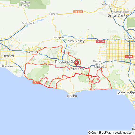
The link to the Garmin Data is here: https://connect.garmin.com/activity/737537389
Here is the link to all the pictures: https://www.facebook.com/media/set/?set=a.10153824555809546.1073741905.585209545&type=1&l=44f8a24191
Here is the link to all the pictures: https://www.facebook.com/media/set/?set=a.10153824555809546.1073741905.585209545&type=1&l=44f8a24191
Here is all our data:
Timing
Time:
|
|
Moving Time:
|
|
Elapsed Time:
|
Avg Speed:
|
12.3 mph
|
Avg Moving
Speed:
|
12.4 mph
|
Max Speed:
|
47.3 mph
|
Elevation
Elevation
Gain:
|
17,457 ft
|
Elevation
Loss:
|
17,448 ft
|
Min Elevation:
|
12 ft
|
Max Elevation:
|
2,363 ft
|
Heart Rate
Avg HR:
|
142 bpm
|
Max HR:
|
206 bpm
|
Zones
% of Max
Temperature
Avg
Temperature:
|
64.3 °F
|
Min
Temperature:
|
32.0 °F
|
Max
Temperature:
|
116.6 °F
|


No comments:
Post a Comment