Tuesday, June 7, 2011

2011 Eastern Sierra Double Century


This has to be the most beautiful of cycling events! The High Sierra Mountains of California are natures playground for many. Epic Alp-like views and diverse climate changes make it just an amazing event.


This year it was just beautiful as usual although somewhat challenging at the end.

I had some business to do for work Friday in the morning so I did that on my way out of town. The weather was nice but the forecast was for some pretty inclement weather up in the Sierra's. I was hoping for the best as I drove north up the Owens Valley. I had a strong tailwind blowing me in my car all the way so I was somewhat nervous about the event. Nothing new!! All the events this year have been challenging due to weather. Mother nature is really making my century quest hard this year!!

I stopped along the way to see my old friend Hugh Murphy whom I have known for years. I first met him while doing his events back in the early 90's. My Wife, Kids and Sister in law used to work the events while my brother in law Vince and I did them on the tandem. We did all the Doubles on the tandem back then. Even before the Triple Crown came about.
I will never forget Hugh sitting in the back of the support van with his legs dangling, at 50+ mph, taking pictures of Vince and I descending off Jubilee Pass on the tandem at breakneck speed on one of the Death Valley Events.
Hugh let me try his trike

I reached Bishop, Ca. at about 5pm and the winds were just howling out of the south.
I checked in at Browns Town Campground and got my van ready for my night. Then I got my bike and gear all ready.
I went and checked in for the mornings event, got some dinner, headed back to the camp, set my alarm for 3:30am, then hit the sack early at 8pm. The wind let up quite a bit at night so I was not too worried.

A couple of cups of coffee in the morning and I was ready to go. The wind was not too bad when I arose.

I drove over to the start, talked awhile with some friends and waited around for the official start at 5am. We watched as a few people started early.


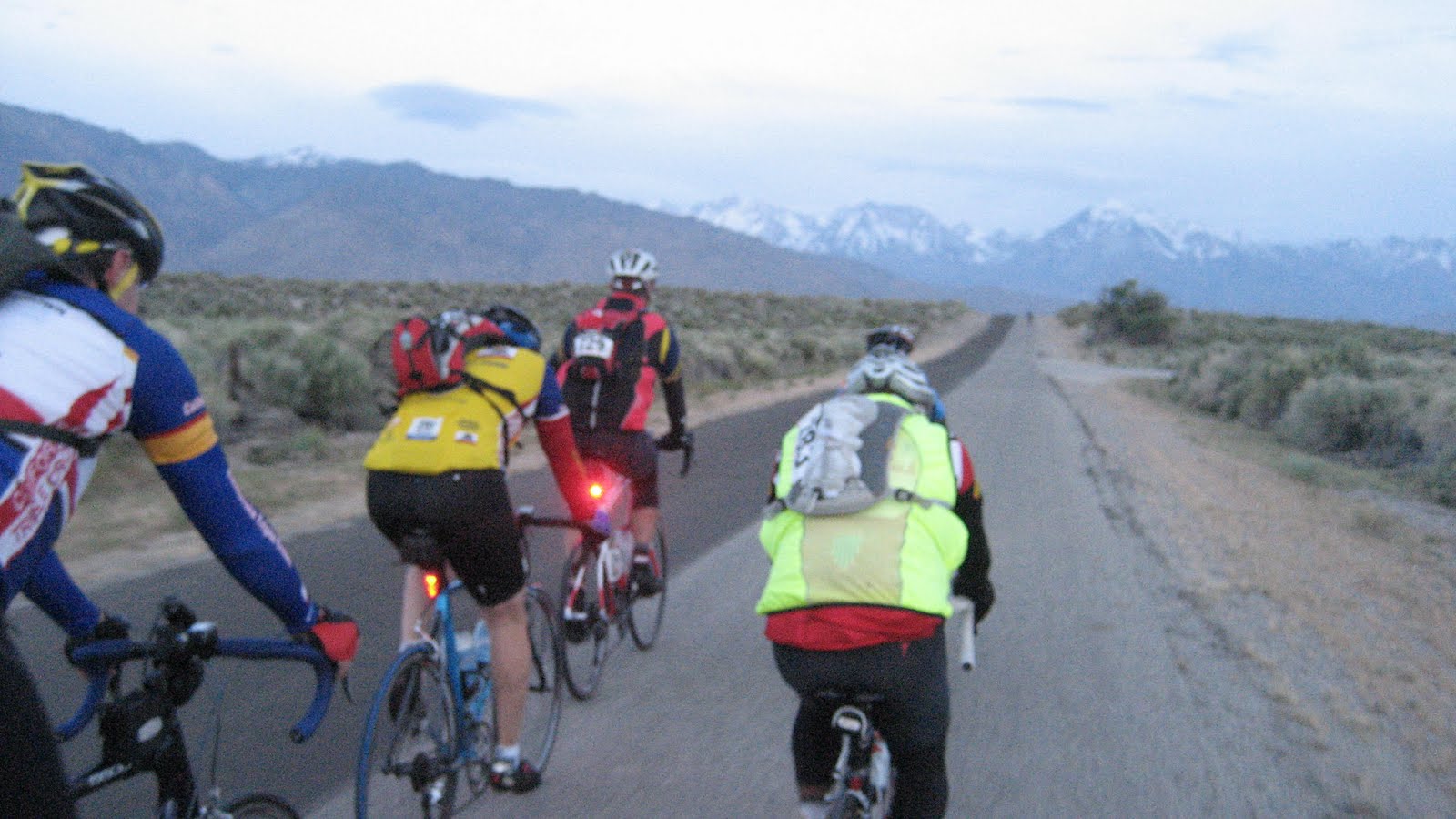
It was a fantastic morning as we started the event. First light in this area is just spectacular. Especially out in the open air riding in it.
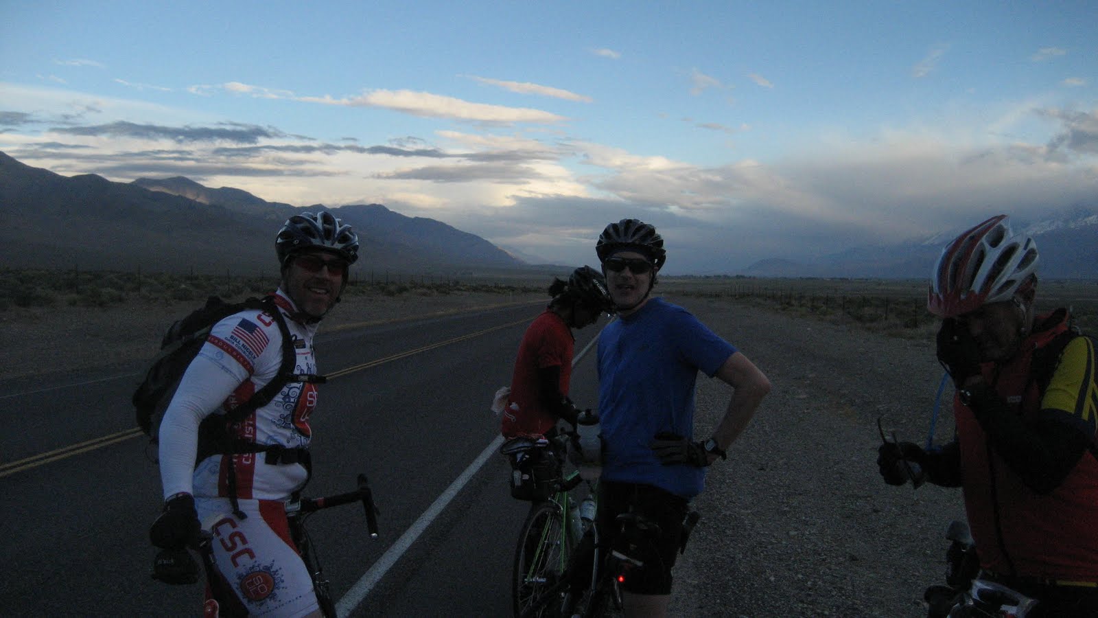
Chuck Bramwell on the left

We headed out of Bishop in a clockwise loop to the East on East Line Street before turning South then West on Warm Springs Road. We then crossed Hwy 395 and headed North toward Round Valley to the North-West of Bishop. I rode this first section with my friend Chuck Bramwell, (the Triple Crown Guy). He is the founder and runs the California Triple Crown Double Century Series. We were in a good size group and had a nice tail wind once we headed North.


The weather forecast was for snow showers up in Mammoth Lakes and June Lake where we were headed so we all were really weighted down with extra cloths and gear. I must have had 5 extra pounds of stuff with me just in case. (you can always strip but if its cold and you don't have enough gear, you are done for the day.)

I had plenty of food and water for over 50 miles, the climbing to come, was totally in a good, "zone", so I opted to skip check point one at Round Valley School.

Onward I trekked toward the first and one of the longest climbs of the day, Old Sherwin Grade. I love this climb!! You feel like you are in the Alps as you climb against the backdrop of the  looming Sierras.

Sherwin Grade in the distance

For those who are familiar with the area, Sherwin Grade is the long climb as you drive from Bishop, North to Mammoth Lakes. You get to the summit of the grade when you are around Crowley Lake area.

We climbed that grade on the old road to the West of Hwy 395.

On the way up we went through one of my favorite little communities, Paradise. This area has one of the best views of the Sierra's. It is an artsy place. Some people display their artwork in their front yards.


Artwork on someones lawn...Paradise.


Just past Paradise
 

2/3 of the way to the summit of Sherwin...looking south-west

I felt fantastic as we reached the summit of the grade at mile marker 39.6. Then we had a little more climbing through Lower Rock Creek before we made a left turn on Hwy 395 North.

We stayed on 395 with hardly any traffic until we made our left turn and headed up Crowley Lake Drive to Check Point #2 at Crowley Lake Park.
I stopped for water and stocked up on more food. My plan on this ride was to stay in my comfort zone so I would not have to stop again until lunch at mile 104.5.

Hwy 395 to the right in the distance


Off we went paralleling 395 until we turned on to it at mile 52.3.

Now it was onward on the Hwy for about 6 miles into the Mammoth Lakes area.


Check the wind sock....wheeew...tailwind
Our old Cessna 402 on another trip to Crescent City
We passed right by the Mammoth/Yosemite Airport along the way. I have great memories of landing at that airport in my Dads Cessna 402 for ski trips.
I will never forget buzzing the mountain once on a nice clear day while flying up for some skiing.
Oh the great adventures we had with Dad in his planes!!
That is a really tricky airport to come into if you don't know what you are doing. The runway is on a hill and is not totally flat. While taking off or landing, it looks like you are running out of runway but you actually have more runway over the horizon. There is also a small mountain on the South-East end of the runway so it can be real tricky in IFR or poor visibility conditions. Not for the faint at heart!
Past the airport we went. I noticed the wind sock was pegged to the North with the tailwind I had to my rear. This made this first stage of the ride nice but did not look good for the finish into Bishop because the winds usually intensify in the afternoon up the valley floor.

Mammoth Mountain
At mile marker 59 or so we made a left turn for a 4 mile climb into Mammoth.
Now the altitude really kicked in. I was somewhat used to some higher altitude from doing Heartbreak the prior weekend but those summits were around 6,000 feet. We now had three summits to do over 8,000 feet and I was feeling it!


I made the climb up to Minaret Road in Mammoth feeling somewhat light headed. I knew it was just the altitude but it really slowed me down. Down into the granny gear I went and I just spun my way up. We went one mile on Minaret and them made the turn on to The Mammoth Scenic Loop at mile 64.


Up we went into the snow zone to the summit on the scenic loop. Then came the reward. The road was newly paved and just wonderful for the 48mph descent down to Hwy 395. It was cold though. Glad I was prepared. No storms yet as predicted.


I turned left on the highway, rode a little under 2 miles, then waved at the guys at Crest view Rest Area. I was happy as I went by feeling really good, still with plenty of food and water.

Deadmans summit ahead
Now came the second 8,000 ft. plus summit. DEADMAN SUMMIT. It is about a 3.5 mile climb. Not too steep but the altitude makes it feel worse than it is. Only about 4-5% grade but it felt like 9% at times with the lack of oxygen.


I stopped at the summit and took a few pictures. The smell of the pine tree is amazing up there!

Down, down now I dropped to my next turn 3.9 miles down the hwy....The June Lake Loop...one of the most spectacular places to ride or vacation.

The June Lake Loop is a 15 mile loop that takes you around 3 lakes at the foot of the Sierra's before you come back out on the other side by Mono Lake and Hwy 395.
Here are some pictures on the loop.

Taken by one of the SAG drivers. Whats wrong with this picture? ITS JUNE!!!


Getting rained on here for the first and only time

We turned left on 395 at mile marker 94.4 for 10 miles to our lunch in the Lee Vining area of Mono Lake. We passed the turn-off for Yosemite and Tioga Pass and it said it was still closed. I was told it most likely wont open until August due to all the snow this year. Amazing!!!

Terri and Tony at lunch....Mono Lake
I saw my friend Terri there. She was staffing the lunch stop.

I gobbled down a subway sandwich, had a coke, used the facilities and then hit the road with a couple of guys I met on the last leg to lunch. Brian from Fresno and Brad from San Luis Obispo. Both strong riders and both doing the Eastern Sierra for the first time.
Mono Lake after lunch

We now had to head Southbound on 395 which meant we would find out finally what the winds were going to be like of the return trip to Bishop.

Southbound we went on 395 to our turn on Hwy 120 ten miles down the road. We had about a 20 mph headwind but not too bad. (yet)

We made a left turn on hwy 120 for the long trudge to the second highest point on the ride....Sage Hen Summit 8,139 ft.
Brian climbing Sage Hen
It seemed to take forever to get there on this stretch. Lots of steep rolling sections of about 10% as it kept kicking up. We saw the highway patrol many times out there and hardly any other cars. I think they were out there just to try and catch one of us doing something.


Brad climbing Sage Hen


It was nice and cool for a change on this climb as we made it to the summit through the pine trees. A nice cool breeze from the south. In years past it was blazing hot on this section with no wind at all.


Brad and Brian reaching the top
Brad, Brian and I made it to the top together, stopped to fuel up and headed out.

The wind at the top was fairly calm. I thought it would be howling up there because the forecast was for winds gusting to 60mph in the mountains of the area. I was excited.


We now had close to a 3000 foot descent and some 30 miles with some small climbs, (some tough), in between before we made it to Hwy 6 in Benton Springs.
Heading toward Benton

As we started the descent the winds were nice and calm and we were cheering!

We came around one bend and BOOM!! We got hit by maybe some 40mph crosswind gusts that dropped our speed from 39mph down to 15 almost instantly, (on a steep descent). Now we were pedaling hard on the descent and working out butts off when we thought we would finally get a reward after that long climb. We really had to fight our way down off this summit. We could see large dust storms in the distance toward the direction of Benton. We knew at that point we were in for it big time on the return from Benton to Bishop.
The head/cross winds on this stretch before the last climb into Benton were not the only problem.
We all thought we were going to break out bikes on the large ruts in the road. This section has always been notorious for these 5+" wide ruts in the road. As long as I have done this ride they have been there and they don't fix them. Even on one of the new paved sections where they paved over them, they are coming back in the same places. I think the old road on this area must have been concrete, separated at the expansion joints and they just paved over it. No way to fix that unless they tear the whole thing out and start new. That is the only thing I can think is happening.

I started to feel a little low on energy and thought I was going to bonk so I let Brian and Brad go ahead while I pumped down some food and slowed down some. I just paced myself over the bumps and into the wind as I climbed and cursed those hills in the middle of the descent. Small ones, seemed steeper into a strong headwind and no relief on the descent having to pedal down the hills instead of resting. ARGGG!!


I finally made it to the final climb before the descent to Benton. I could see Brad and Brian climbing the hill up toward the top.
I hammered up, hoping that I could catch them on the downhill. It is a fast descent into Benton!!


I had some strong cross winds right at the start of the descent then I turned north some and was just flying at close to 50mph with a tailwind.


The descent to Benton. All that haze is dust!! Brad up ahead
 I should have just relaxed instead of trying to catch those guys because when I made a right turn for the final little drop to Benton I got hit with a crosswind that almost blew me off the road. Good thing I have fast reactions.
I slowed down some then I saw Brad up ahead just almost stopped. He was just burnt out with only about a mile to got to Benton. The SAG car came by and he stopped him. I thought he was going to call it quits with only 37 miles left. He was just asking the driver where the checkpoint was.
We both rolled in to the check point in Benton at a little after 5pm I think. The wind was howling and getting stronger.

We fueled up and rested for a little while. Myself, Brad, Brian, a guy named Gustavo from Davis, and another rider John all decided to team up and finish the ride together into the wind. We were all going to take no more than 1 minute pulls at the front of the line then drop back to the rear. This way we could get back much faster than if we rode alone with no drafting effect.

The last 36 miles took over 3 hours and it was a mind altering experience.
The last time I did this ride in 2009 I had a tail wind on this last section and it took me slightly over one hour as I got blown back to Bishop.

Here is a video that gives a small idea of the wind conditions we faced.
Children do not try this at home. Professional driver on a closed course. (trying to take a video while trying to hold the draft in a pace line.....nuts I know!!)


Rest #1 for a breather

Rest #2

Left to right. Gustavo, Brian, Brad, Me and John.
We only averaged about 10mph with a group of 5 riders on that last section. The winds were gusting in such a way that it kept trying to blow us out of the line so we would lose the draft and have to sprint back in line.
In the end we all worked together as a team and we made it back just slightly before dark.

Start time: 5am
Finish time: Sometime around 8pm.
Time on bike; 14:16
Overall time: 15:18
Altitude gain: From my VDO computer: 10,610 ft
Average climb: 3%
Maximum climb: 13%
Results: http://www.planetultra.com/easternsierra/Results/2011%20results.htm
All the Pictures can be seen at: www.stephenpaul.shutterfly.com/cycling

Wednesday, June 1, 2011

Heartbreak Double Century

This ride is one of the toughest of the Triple Crown Doubles. It has around 16,000 vertical feet of elevation gain and that, in itself makes it pretty challenging.
It is one of my favorite rides so I thought it would be fitting for my 97th Triple Crown Double.

I did this ride for the first time back in the early 90's when it was done as a re-route of the Tour of Two Forests Double. Due to heavy rains, the mountain came down on the road above Wheeler grade going out of Ojai, Ca. so they devised this new route until the road was repaired. It became an epic route to say the least.

I was somewhat worried about the ride this year. The forecast was for winds steady out of the north-northwest 20-30mph gusting to 60 mph.
Although it didn't quite turn out that bad it was still very challenging for the first 70 miles or so.
(I'm talking about challenging winds. This ride is always a real challenge due to the climbing)

The ride start was at the Holiday Inn in Palmdale, Ca.


Julie and Frank checking us in

As usual I ran into a few friends at the start. Some doing the ride and others supporting it.


I saw Tony, one of the fixie riders I rode with at the very rainy Solvang Double this year. Never saw him again after that as he hammered this one.


We rolled out of Palmdale at 5:15am, about 57 of us, plus or minus a few. The winds were calm when we left and headed West on Palmdale Blvd. As soon as we started up Elizabeth Lake Road and the sun started rising, "the winds came with a vengeance". They were not as bad as Death Valley this year but still a challenge. I think that maybe I was not quite recovered from Devil Mountain and the tough 3 weeks prior to this ride. I really had a hard time getting into my zone and I started real slow. The wind made this even tougher.

The wind was about 20mph and gusting to 35 I figured. It was also very chilly. In the mid 40's when we started climbing toward Sandburg.

Heading up Pine Canyon Road toward 3 points
We rode past Elizabeth Lake and Lake Hughes before starting the climbing up Pine Canyon Road to Checkpoint one at 3 points. Mile marker 30.

Thanks Jon and Jennifer for the great support at check point one and on the return route.

We continued climbing into the headwinds up Pine Canyon for 8 miles to "The Old Ridge Route". I believe this is the old road that went South to North before Interstate 5 was built.


Looking down one of the climbs on Pine Canyon, almost to the Ridge Route

Sign on The Ridge Route
I made a right turn on the ridge route and then had a nice 2.3 mile descent down into more headwinds to Hwy 138 for a left turn to Gorman.

I couldn't help but remember that it was on a day such as this with nasty winds that my wife Ginny and my youngest daughter Nicole got blown off Hwy 138 and flipped the car. They were on their way to staff one of the rest stops on the event. It was a nasty accident and they both walked away from it! The car flipped end over end. Angels were definitely watching!
I was doing the ride and when I reached Lebec, Hugh Murphy, the organizer of the ride that year, told me what happened and that they were ok. Someone who passed by gave them a ride to the Flying J where the checkpoint was so they could call the CHP. I stopped riding at that point, had breakfast with them and went home. The wind was about the same that day.

Back to the current ride.

When I turned left on to hwy 138 the winds subsided some and it was not too bad for the 2.5 miles until the turn on Gorman Post Road. I just got into my aero bars and smoked that section. I was feeling good now and into a rhythm. Could the winds be starting to subside, I thought.


 No such luck. As soon as I started the climb toward Tejon Pass and Gorman the winds really kicked up again and with a vengeance. I caught a couple of guys on the start of the climb. They were much lighter than I and the wind was pushing them bad.
Caught up to these guys as I started climbing Gorman Post Road. The wind was almost blowing us backward on this not too tough of a climb.
 After going over that first little climb in the wind, I got down into my aero bars and just powered into the wind as it wasn't too steep from that point to Gorman. The winds were really howling and funneling through that pass as anyone who has driven the Grape Vine would know.

I wonder if someone got hit by the O in Gorman as the wind blew it away....ha ha.
 I left Gorman and trudged over Peace Valley Road to Tejon Pass. Now it was down and pedaling into a headwind again to the town of Lebec for checkpoint #2 at another Holiday Inn. Mile marker 50.5

I got water and food, then started what was, for me, the toughest section of the ride. The climb to Apache Saddle, the highest point on the event.


Heading into Frazier Park

Up we went on Frazier Mountain Road/Cuddy Valley Road for 11.5 miles of gradual to steep uphill. This part has always seemed tough to me as it just seems endless.

After going through the Cuddy Valley we started the last ascent to our turn on Mil Portrero Hwy. Now it was onward to Apache Saddle.
 We made a right turn through the pine forest for a very welcome and windless descent toward the community of Pine Mount Club.
 After the turn we had 8.3 miles to the Saddle and the descent wasn't long enough as we started climbing real steep again toward Pine Mountain Club. We had 10-12% grade getting to Pine Mountain Club. This area was really nice and I would love to come and take a vacation here with the bike.


Now we had another steep section to get to Apache Saddle and we finally made it. Check Point 3. Mile 71.1. I fueled up and headed onward.

Now we finally had some relief!! 71 miles complete as we dropped and dropped down Mil Portrero Hwy toward Hwy 166. 21.2 mile with a few little bumps in between and mostly down hill off the mountain.
You could see California's central valley on the way down. Spectacular!!

We cruised on Hwy 166 for 4.5 miles into San Luis Obispo County before we made a left turn on Hwy 33 South and the lunch stop at "The Place" in Ventucopa. Mile 104. It was really a tough first century. It took me around 9 hours with all the climbing coupled with the wind. I sure hoped we had some tailwinds for the return. We had Sub sandwiches and sodas. It was good!!


Napping? No just kidding. I felt like it though.


Now I headed for the infamous Lockwood Valley Road.
I had 12.2 miles of rolling roads with tailwinds.....woooohooo!!! I didn't push hard and just recovered after lunch for what was to come.
Looking to the South I could see the big mountain range that separates where I currently was at from Ojai, Ca and the Pacific Ocean.
I made my way up Hwy 33 until my turn toward Heartbreak Hill on Lockwood Valley road.


Heading up Lockwood Valley Road
Heartbreak Hill itself is not all that steep. It is the approach that makes it tough. From the turn onto Lockwood Valley Road, you have about 10 miles of gradual climb which gets progressively steeper as you get closer to Heartbreak. The section just before is the hardest and then the crest of the summit doesn't seem quite as bad. Only about 6% or so.


On the steep part


My Rubaix looking back down Lockwood Valley Road


Today the temps were mild and it was not too hot on Lockwood Valley as it usually is. It wasn't too bad.
I made it to Check Point #4 feeling pretty good, (no cramps for a change). I filled my Camelbak with water and headed out. 17 miles now through the pine forest with two higher passes before a descent to Frazier Park and Lebec. The next two passes were not too bad. Over Owls Barn Summit I went. Tailwinds now as I descended at speeds from 20-45 mph into Lebec and CP5.
I was now at mile 150.7 and started the return climb over  Peace Valley Road with a tailwind. Over the top and on to Gorman Post Road for a spin fest as the tailwinds blew me faster than I could pedal. I turned left on Hwy 138 again this time Eastbound with more great tailwinds.
Now the climbing started again as we climbed up the "Old Ridge Route" road again to Pine Canyon.

Old Ridge Route ahead

Heading up the lower slope. Old Ridge Route
2.2 miles up to our turn on Pine Canyon.


Sunset on Pine Canyon


 We dropped down for awhile, then some more climbing before our final check point at Three Points. I said hi to Jon and Jennifer, filled up with fluid and headed out. It was getting dark now as the sun had just set. 30 or so miles left....home stretch, but not before a couple of tough climbs left. One of them was pretty nasty at this point in an event. I trudged over with many large grunts and then enjoyed the nice drop into Lake Hughes. Now I had a slight tailwind all the way back through Lake Elizabeth for the return to Palmdale.

Very tired.....another one in the books. Three to go on my quest.

202 miles
16,000 ft. elevation gain
Ride time on bike: 14:40
Overall time: 16:30

To see the rest of the photos, go to: www.stephenpaul.shutterfly.com/cycling

Monday, May 2, 2011

The 2011 Devil Mountain Double Century

"For the mountains shall depart and the hills be removed, but My kindness shall not depart from you, nor shall My covenant of peace be removed"


On this day, my brother and I conquered Devil Mountain together.

We lost my younger brother on the day after Easter.
I felt Dave along side me as we ascended some the the highest peaks in the area East and South East of San Francisco. Mount Diablo, Mount Hamilton and the infamous Sierra Road to name a few.


Dad with Dave


For the first time since we were kids he was with me, on his bike, along side, ascending those almost 20,000 vertical feet of elevation. We will all miss you little brother.


Now for the ride report:

We went to the Bay area and stayed with friends who lived in the East Bay town of Pittsburgh, only about 20 minutes from the ride start in San Ramon.
The whole way up the San Joaquin Valley, the winds were howling and we started to worry about the event conditions. The winds were coming from a unusual northerly direction for this time of year.

Things were nice and calm for the ride start in San Ramon at 5am. The temps were in the 40's so we were figuring that it would make the first mountain assault more pleasant.


I put on my ride number and made my way to the start. The largest group of riders started at 5am due to the cut off time which we have to make by mile 90 on the course.
The cut-off was as such: We had to leave the Mines Road check point at mile 90 by one pm or we cannot continue on the course and we get a "DNF" (did not finish)
That's 8 hours to do 90 miles and about 9,000 feet of climbing. If you make that cut-off then you are in good shape. Sounds easily doable.


We all gathered at the start for the ride meeting with all the final instructions.


I saw my friend Ken there who I rode much of the Solvang Double with this year in the rain. He was riding his "fixed gear" bike on that one. Not on this grunt of a ride. He had one with gears and plenty of them.


We rolled out of San Ramon right on time and started climbing almost immediately toward Mount Diablo on the city streets on the outskirts. Some of the riders really took off fast because they were doing the "Triple Crown" stage race which is a race within a race on these events. They take the combined times from the riders on the three most difficult double centuries and the winner is the one with the fastest time.
Some of the guys who were racing just flew out of the gate and some of the real fast ones started in the 6am group because there is no way they would miss the cut-off because they are just too fast.

It was just starting to get light when we reached the lower slopes of Diablo. This mountain is the largest one in the East Bay area and if you take interstate 5 to San Francisco you cant miss it. It is the big, double peaked, mountain north of Livermore. It can be seen from a long way off in the distance on a clear day. Even from the San Joaquin Valley!
Starting the ascent up Diablo
It was then on the lower slopes that I had my first problem. I got a flat tire. I fixed the flat and was about to pump it up when the SAG driver came up with a high pressure pump. After pumping it up, we had some trouble with the brakes which I somehow knocked out of alignment so he adjusted them for me. (awesome support on this ride, I got to tell you!!!)
Having never done this ride before, everyone told me not to cook myself before Mines Road which is a difficult 25 mile, hot, gradual climb that can really burn you out if you don't pace yourself.
Now, with that 1pm cut-off time on my mind, I started to get stressed and started to push much harder than I wanted on the last 2/3 of the climb up Diablo. I still stayed within my Aerobic zone on my heart monitor though so I was fine.
It was such a beautiful climb. You could see the East Bay, San Jose, Livermore, The Golden Gate and the City, all during points of the climb. Just awesome and I really felt like Dave was with me up on that mountain.

The wind was howling on the mountain which also slowed us up some.

Heading to the East into the sunrise about 2/3 of the way up Mount Diablo

Me at the top with San Francisco in the background

The above video shows just how windy it was on the mountain. I saw my friend Ron Ng up there working the stop. I almost didn't recognize him without his cycling gear on.  The support crew had a real tough time mixing the drinks. When I filled my Camel-Bak with water I think the wind was blowing more of it away than I was getting in the reservoir. It was freezing up there too with that wind chill at just after 7 in the morning.


San Francisco and the Golden Gate in the distance

We had a real cold drop off of the first mountain and I could hardly feel my hands when I reached the bottom in Walnut Creek. It was warmer there though and I warmed up quickly and started to strip some of the layers.
We had some nice riding through Walnut Creek before we started to ascend again on the North side of Mount Diablo. We went up on the South-West side and came down on the Northwest side. Now we were riding along the foot of the big giant on the North side which had some small climbs on it.
We headed east at its foot and then made a turn on Morgan Territory Road. This road was really pretty and all tree lined in a canopy. Very cool temps and windy still. Some very steep sections on this long climb which ascends the East foot of Diablo I'll call it.


Morgan Territory Road
It was almost a 10 mile climb up to the second check point at Morgan Territory Park. Very steep in some parts but not too bad. Had to keep thinking about that cut-off though. I couldn't get it out of my head. I really wanted to finish this thing for Dave.

Right after the check point we started a steep descent down to Livermore called, "the plunge".  It is a steep drop of about 5 miles on a single lane road and it was really windy with gusty cross winds. A rider went down not far after the start of "the plunge" and the fire department was stopping everyone and not letting them through until the ambulance could get there from down the hill. They didn't want anyone to hit the ambulance.  We had to wait about 25 minutes in that cold wind. Now I really started to worry about the cut-off time. I was hoping that they would cut us some slack due to the situation. (by the way, the rider was ok. He had to be taken to the hospital but was released with some broken ribs.)

Waiting for the Ambulance
We then had to all follow the ambulance down the hill and we were on the brakes the whole time because it was a slow decent for him too.

We then traversed over to the Livermore area and then headed East to Altamont Pass which takes us over into the San Joaquin Valley.
 Altamont Pass was a really nice climb on a real nice road. We had great views of the large windmills. Altamont Pass is one of the windiest places so it has the windmills everywhere to catch the wind funneling in from the Pacific. On this day the wind was coming out of the North so we had a nice cross wind instead of a tailwind from the ocean.

It was on now to our next climb....Patterson Pass. I did this climb about 15 years ago when my wife Ginny dropped me off in Tracy, Ca and I rode to the East Bay to our friends house on my bike. I didn't remember it being hard at all. 15 years can make a difference I guess.
Now it was quite warm as the wind was more behind us and had calmed some. We climbed for about 4 miles and I finally took off my leg warmers and arm warmers. Getting hot.


Patterson Pass with the windmills

We came up over a little bluff thinking that was the top and then I saw writing on the rode that said. "Look up at OH MY GAWD HILL". I looked up and instantly saw what they were talking about. I don't remember that when I did this before, I thought. It looked nasty. Someone said it kicked up to 20% at one small point. Dont know about that but it was steep for a short time.

Would you look at that!! WOW
I checked in at the water stop and headed up over the summit.  Somehow, it looked worse than it felt. I just paced myself and it wasn't all that bad. (if you call climbing out of the saddle at 3 mph not that bad...)

OMG


In the old days I would have done that without a granny gear. Being close to 60 does change you some I think. Haaa!

Over the top we went and headed back toward Livermore and the left turn onto Mines Road. 3 miles from there to the cut-off time destination.

I got there and left with a half hour to spare. Woooo hoooo. Flat tire...bike problems....ambulance....taking my time and I still made it....Priceless!!

Now we had 25 miles of gradual to sometimes hard uphill to the lunch stop at the Junction Cafe. This was a hot grinding climb that seemed endless. Now I know why everyone said not to "cook yourself" before Mines Road. It seemed never ending.

Two local guys doing it for the first time. Thier goal was to finish before midnight
I felt great when I got to lunch and spent little time wolfing down a chicken sandwich and a drink. I stayed too long for my liking and then started what was the assault on Mount Hamilton. 18.34 miles of mostly uphill and getting steeper as you get closer to the summit. Sooooo beautiful though.

Follow the road as far as the eye can see and then some. We came from out there somewhere.
 Wow what a climb.
This section we are doing, the ascent of Hamilton, the decent down into San Jose and the Attack of Sierra road are all going to be on one stage of the Amgen Tour of California, this year with a mountain top finish on Sierra Road. Watch it....it will be awesome and you can say...wow...Steve and Dave rode that!

Just before the assault on Hamilton I got another flat tire after going over a cattle guard. From this point on, I am not doing a long event like this with only C02 cartridges and no pump. I had one tube left and only two C02's left. After putting the tube in, I blew up the tire because it was pinched between the rim and the tire. Then a nice guy named Chris stopped and gave me a tube. I re-fixed it and he let me use his pump to pump it up. Then the SAG crew stopped and I used a floor pump for better pressure. Much better. Then I had problems with my derailleur. To make a long story short.....it turned a fast flat repair into a 25 minute time loss.

We continued up Hamilton and I felt good after the long rest. It was beautiful at the summit as we rode by the observatory. The view of the South Bay below was great.

Now we had a very technical 17 mile decent down the mountain into the San Jose area. I kept getting stuck behind cars who just cant make a decent like this as fast as a bike. After they let us pass we never saw them again even after we were in the more straight section of road toward the bottom.

The snaking road to San Jose

We flew to the next check point.
The sun was getting low and there was a chill in the air so I started to put some layers back on. I fueled up real good and maybe was somewhat too heavy on water but I was sure going to be ready for what was to come. 
Sierra Road!!


We were where the arrow is pointing. Look at the profile of the next climb...Sierra Road. Straight up!


A 4 mile climb from the flat lands of San Jose. 17% gradients almost from the start with a few forgiving sections of 9-10% in the middle. Ouch.

My sister told me that all the problems I had so far was Dave just teasing me and holding me back on purpose. He was really known as a teaser when he was young, as my 4 sisters can attest.

After climbing Sierra Road I know she was right.

If I hadn't had the hold ups on this ride, I would never have had the chance to see the most spectacular sunset I have seen in years. I got to see the sun setting over the Bay from all different angles as I ascended Sierra Road. I must have stopped 7 times to take pictures and videos. I feel blessed that I was able to see such a sight. Wow.


Between pacing myself properly and stopping to look at the sunset, this climb didn't seem half bad after almost 160 miles and over 15,000 feet already climbed.

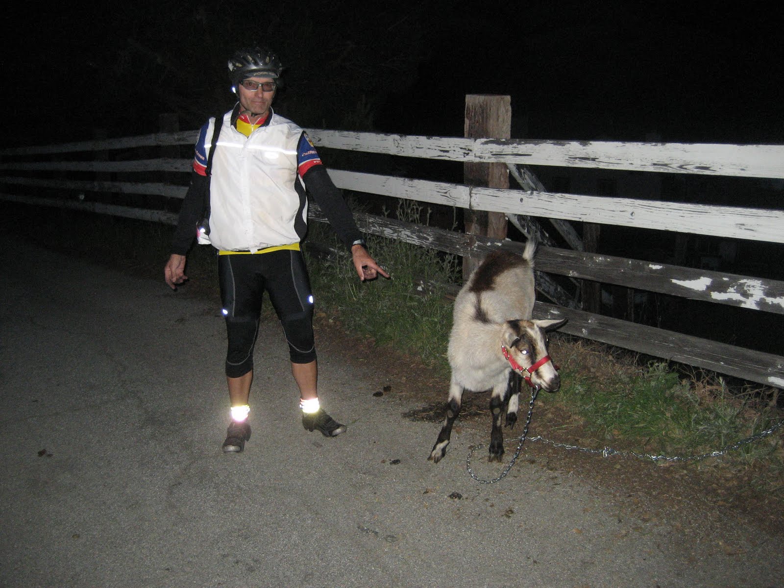
And........I got to "Pet the Goat" at the Pet the Goat check point at the summit. Does that mean we are considered to be "Mountain Goats", now?


Sunset over San Francisco Bay...WOW


From the very top with the sun set


I am the mountain goat


I was drenched in sweat at the top and it was almost completely dark. I pet the goat, fed the goat, fed myself, layered up, watered up and started the cold descent to our next climb, Calaveras Road. I was shivering so much on the way down I had a hard time holding the bars. I had to apply brakes and pedal so I could heat my engine back up. The human body is an engine after all. Rapid cool down is not good for any engine. The temp dropped about 20 degrees on that descent.

To top that off, Dave decided to tease me again.
I missed the turn in the dark on Calaveras road and descended all the way down to the town of Milpitas before I realized the mistake. Then I noticed that my route slip had blown away. (I had two and this was my second)

I think I dropped about another 1,000 feet. I turned around and I figured if I had not missed the turn, I would see other riders coming down. I saw none and then after another long climb, I saw the turn. I was going so fast on the decent, I just blew right by. Stupid, brain dead kind of thing to do I know with all my experience. It happens to the best of us....but....wow what a day this has been so far.

About 16 more miles of up and some down and I was at the final check point. Sunol Train Station.
I saw my friends Jason and Alfie there who were working the stop. Thanks guys for the awesome Miso soup and boiled garlic potatoes.

Off we went in a group of 4 for the final 25 miles and the finish. Still some climbing to do though. Boy....are there not any flat sections on this course?
I started to get real sleepy now as it was late in the night. I was thinking that I should have had something with caffeine in it at the final stop.
Sleepy on the climb but boy I woke up quick on the next decent with that cold in my face.
Then we had a semi uphill, nice section with about 8 miles to go on Crow Canyon Road when it happened again. A front tire blow out. Don't know what I hit but it was something sharp.

One tube left and one C02 left... middle of the night....freezing....shivering....just tell yourself Steve....you can do it.

Well.....got the tire fixed....but....only got about 40 or 50 pounds in the tire because the cartridge was bad or something.

Knowing I only had Norris Canyon to climb and descend before the finish, I decided to risk it and I just nursed the bike over the hill and down the other side. In one respect I was lucky it was the front tire because I could put most my weight to the rear but on the other hand if the decent was curvy, I risked the front tire rolling off the rim.
Well.....Dave and I made it.
Not a pretty one in the time category but at least I got through this most epic of events. I already want to do it again.

Start time: 5am
Finish time: Somewhere around 12:30am
Overall course time: 19.5 hours?
On bike ride time: 15:57 hrs
Elevation Gain: 19,960 feet

For all the pictures: http://www.stevemeichtry.myphotoalbum.com/
Here is the ride map someone made of the event...awesome: http://ridewithgps.com/routes/385101

Summer and Fall 2025

  After getting through my back surgery ordeal and finally doing my 200th double century back in June, I decided to round out the year with ...