Friday, May 27, 2016

2016 Central Coast Double Century


The Central Coast Double Century is one of the most beautiful bike rides on earth.

 It starts out in the Central California wine country town of Paso Robles. The course takes us west of town for some amazing climbs and descents through wine country before descending to the Pacific coast at Cambria, Ca. just south of San Simeon. We then head North on PCH to the southern end of Big Sur before climbing over the Santa Lucia mountain range to the Salinas Valley and the return to Paso Robles.

I have done this event 3 times before but I had never done it on a tandem bike before so when my friend Teresa said she would like to do it, I jumped at the chance. She had done it a couple times before on tandems but never on her single bike.

This event has a highland and a lowland route. The high route takes you up to and around Lake Nacimiento before dropping to the town of Bradley along Highway 101. The high has close to 16,000 feet of elevation gain.
The low route cuts out the climb to Nacimiento and a few miles for a straight shot to the town of Bradley. Elevation gain on the low is about 14,600 feet. That is a tough lowland route!!

We were planning on doing the tough highland route.

Teresa and I had not been on the tandem since our last event, the Southern Inyo Double where we had a major crash due to weather conditions blowing us off a really wet road.

When we arrived in town Friday night we took the tandem out for a shake-down spin of about 18 miles to make sure everything was working well.
We rode to Paso Robles from the house we were staying up in the hills, to rider check-in. 
 We felt good and the tandem was working nicely. I had just had it in the shop for new handle bars and stem so I wanted to make sure everything felt right. I did take it out myself after the work but not with my stoker on the rear.


Part One: Paso Robles to check point one. Santa Rosa Creek Summit.                                   Mile 0-30.7


Elevation gain: 3,365 feet

We rolled out of the start at first light which was around 5:45 am. We saw many of our friends as usual. When you have been doing this type event as long as we have, you get to know almost everyone. There are really not that many people that do these ultra-events in comparison to other sporting events.
Getting ready to roll


It was a beautiful ride through the rolling hills and steeper climbs out of Paso Robles. We went by many wineries. We were pretty slow right out of the box because it is quite a while before we stopped climbing after leaving town. We had to climb over the mountains to get out of town.


We were off the back of the group but hoped to really catch up after going over the mountains.
The descent and headwinds along the coast were to our advantage.

The first climbs were not too tough….just slower on a tandem.

Then came the two toughest climbs on this early part of the event, York Mountain Road and Santa Rosa Creek Road.
Scott Halverson climbing the very steep Santa Rosa Creek road

These were tough on the tandem. With gradients between 12-20%, I dropped it in the granny gear, we put our heads down and just toughed it out as usual. After all…..we have quite a history of doing tough events on the tandem.

There was poison oak everywhere along the road in this section. I don't know if I have ever seen this much and it so healthy. It is too early in the year to see its fall-like color which makes it more noticeable but I know its tell-tale leaf pattern. We were careful not to brush against it.  

We grunted our way up to check point one but made it in the rear of the group but still not last. We were climbing pretty strong.
Grinding up the final 20% section leading to the check point on Santa Rosa Creek 

We got water and made it a fairly short stop.


Part 2: Check Point One to Ragged Point                                                                                       Mile 30.7- 66.8


Elevation gain; 1,526 feet

The descent down Santa Rosa Creek Road is very technical and bumpy even on a single with a very tricky hairpin turn a few miles from the summit. It then drops steeply before the grade flattens out a little.

I planned on taking it nice and easy on this descent and felt very confident now that I had disk brakes. They had worked great on many others, much more difficult, than this one. I just took it easy and did not let my speed get up too much. The tires really cushioned the ride nicely and the bumps did not bother us much at all. I was running new, all condition, Specialized Armadillo tires. They are 28’s and I was running just under 90 lbs. in them.

The bike slowed down nicely on all the curves but when we got to the descent where the hairpin was, I noticed something was seriously wrong. I was losing braking for some reason. (This is not supposed to happen. Everyone said disks were so reliable on descents. All kinds of things were going through my head at a very rapid rate)
I just had the bike in the shop and it worked fine the day before and on my test ride.
You can see how steep and tight the hairpin turn is if you look down and to the right.

It gets steeper as you come to the turn. Really scary!!

I was now diving from high in the turn to low so I could come out high and hopefully make the turn at this high speed.

My brake levers were all the way compressed against my handle bars and the bike was not slowing down as much as it should.
I yelled out to Teresa that I couldn’t slow down completely and I went into survival mode!! I went very high into the curve on the left and then dropped low before coming out high on the other side. I rolled into the dirt on the left side coming out of it and thought I was going to lose it there but miraculously Angels were watching over us because I saved it.

It was then that I remembered the road up ahead and saw it. The road goes straight but becomes even steeper with and nasty dip of over 20% a few hundred yards up ahead. I had the brakes full-on and I still was accelerating!!

It was at this point that I made a split second and very difficult decision which could save very serious injury or worse.

I yelled out to Teresa at this point that we were going to have to get off the bike because I had no breaks. I took the bike off-road and into the dirt on the right side hoping that I could just roll up the hill on a slight angle kind-of like a truck brake failure ramp thing. 

Well……no such luck!!

 I must have hit a rut or rock in the bushes as I was slowing down not far off the road. All I remember is a pretty violent hit and my neck and back cracking like I was getting a chiropractic adjustment.

We ended up with the bike flipped 180 degrees and Teresa 180 degrees from where she was behind me. I think when we hit something, she plowed into my back before flying over me for a fairly soft landing. Her shoulder hurt a little but all in all she was shaken but OK.

(The following two videos are of the crash. One at regular speed and one in slo-mo. You can actually tell we are still accelerating coming out of that nasty turn!!  In the slow motion video, if you look closely, you will see Teresa hit me straight in the back and then fly to the right and behind me as the bike flips in the opposite direction.)


Regular speed video


Slo-mo video


I was not so lucky.
My neck and back were not in too good of shape and I was worried. I was stunned but felt pretty good when I stood up. Then I tried to walk on my ankle and thought it was broken.
Some of our friends stopped and helped us. They helped me check out the bike and everything was ok. Hardly a scratch on the bike. It was the brakes I was concerned about. Was it cable stretch or worn out brake pads? Someone looked at the pads and I still had plenty of wear on them left. What the hell happened!!

My friend Tony helped me tighten the cables so the levers gave me some braking power and we thought we had it fixed. 

I've done over 40 doubles on the tandem dating back to the late 80's with not a single fall (not even a clip-out incident). These last two incidents were just freak things, both, causing me to make a split second decision that was very difficult but hurt. Glad I was able to break my stoker's fall in both of them. Teresa Beck is one incredibly tough woman.

We decided to ride the bike down to the coast and see how we felt before quitting the ride due to injury. This happened at mile 35 and we had about 160 miles to go. All that was going through my mind was……How the heck am I going to make it 160 miles in this shape!!!

Teresa and I walked the bike down that really steep kicker. We then gingerly finished the descent which was not as bad from that point. I seemed to have good braking power on the rest of the grade but it still did not feel like when the brakes were new.

  Cindi Staiger, who is on the staff for this ride, followed us down the hill in the support vehicle to make sure we made it down ok. Thanks Cindi!

For many of you newbies who do not know, Cindi Staiger is the 1988 winner of The Race across America. I remember watching the race and seeing her win back in the late 80's when I was first getting the ultra-cycling bug.

We got down to Cambria and I had to stop at a stop light. This is when I really noticed that I was not getting full braking power. There is no way I was going to do any more descents and I told Teresa. I was having serious thoughts of quitting at this point. My ankle was killing me and my back was feeling really strange.

We stopped on PCH and then Brian Stark, the organizer of the ride pulled up along with one of his mechanics to check on us. His mechanic (whose name I do not remember), saved our ride although at this point my body was telling me otherwise as far as finishing.

He checked the brakes and said we had plenty of pad left. He then noticed that he could move my wheels even when the brake levers were fully pressed…..both wheels!!! He then found the problem!! Only one pad was contacting the rotor, not both. He did a 5 minute adjustment and I had such powerful braking power that I couldn’t believe it.

How could this happen?!?!  I just had the bike in the shop with the guy who installed the brakes!

Well….Long story short….in hindsight I think I am partly to blame. I know nothing about disk brakes and am a very trusting person by nature. (Maybe too trusting but that’s just me). I took it for granted that he checked everything out when I had the bike in the shop. He took it for granted that I knew how to tell when the brakes were out of adjustment.

From now on I am doing my own brake adjustment before every long event……Period!!

We rolled up PCH, I figure, over an hour behind everyone else into an ever increasing head wind. White caps were starting to form on the pacific as we rolled through San Simeon. My ankle was sore but started feeling better as long as I didn’t do any lateral motion. The Advil was starting to take effect and my back started feeling better too. (I knew that recovery was going to be a different story in a few days) I figured if anything was broken, I would feel much worse.
Cruising through San Simeon


Climbing one of the many hills along PCH


Teresa was very strong and we both started feeling better and were starting to get over the shock of the accident.
We both discussed it and figured we would attempt to finish the ride even if our time was not an official finisher’s time. If we could not make the cut off for the highland route we would switch to the lowland.

It was a really tough coming up the rear of the ride in that head wind but it was a spectacular day and the beauty of it all just made it easier. I couldn’t push my usual big gear and had to spin more due to my ankle which slowed us down a bit.
The support vehicles kept checking on us to see if we were OK.
What an amazing staff Brian Stark had put together!!

I don’t think anyone had any hope for us after that crash but we were determined to take it one step at a time. Our first hurdle was the coast which had a lot of climbing. The second was the climb over the Santa Lucia Mountains on Nacimiento-Fergusen road. If we could make it over these two hurdles under the cut-off we hoped to be OK.

After a beautiful ride to Ragged Point we pulled into the check point in last place as they were starting to break down the rest stop. We stopped longer than we wanted but needed it at this point. They told us we really were only about 20 minutes behind the last riders so we figured we must have made up some time in the head winds. It is a lot easier for a tandem in a head wind. You are much heavier and the wind does not blow you around as much.

I was feeling pretty crappy!! It was not only windy but a lot of climbing along the coast. 


Part 3: Ragged Point to Mill Creek and the start of the climb inland.                                            Mile 66.8 – 87.4                                  


Elevation gain: 2,068 feet


Check out the white caps. It was brutal in this section.

Finally a little calmer water

We continued up the coast toward Big Sur. It was so beautiful and the pacific was so colorful. I started feeling much better once we reached the coastal summit and had a nice long descent. It really helped me recover. This section of the coast is so spectacular all the way to Monterrey. We would be turning inland about 60 miles from Monterey.

We made up a little time on this section and when we reached the Mill Creek check-point we caught a few riders. One was quitting and the other was going on. One other had just left and started the climb. Now comes the really tough part!!


Mill Creek. Now it really gets tough!


Part 4: Mill Creek to Lunch                                                                                                                Mile 87.4 – 112


Elevation gain: 3,188 feet


We now started the very difficult Nacimiento-Fergusen road. The climb starts right off the bat at about 11%.

I put the drive-train in the lowest gear right from the start knowing this climb very well. It is relentless for about 7.4 miles straight up!!

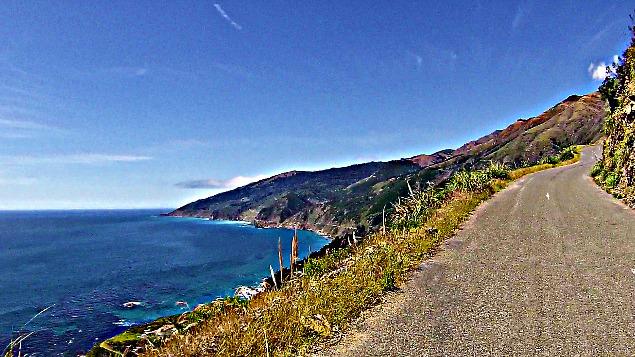
The first part of this climb is so beautiful its amazing. The view of the Pacific Ocean and the Big Sur area is breathtaking.
We ran into a guy named Ed from Fresno area and he did the climb with us. This was one of his first double centuries.
My ankle was really bothering me so I could not climb out of the saddle with all my weight on the legs where it was really steep. Teresa had to literally push me up some of the slopes by getting out of the saddle for some more momentum. When it leveled to under 10% I was fine. About half way up the gradient becomes a little easier but with so much climbing in the legs already, it was difficult.
Up and up some more we go!

Looking south down on PCH

Looking at north-bound PCH down below


Looking way down at the Pacific. Starting at close to sea level,this picture is taken about 1/3 of the way up. You can see the road switch-backing up that small first hill on the bottom right.

We took lots of video and pics where ever we could.

We made it to the water stop at the top and we were ecstatic.

 We topped off and headed down the steep descent on the other side. The brakes worked effortlessly but I still took it very easy and slow. I was a little skittish after the morning ordeal.

After the initial few miles of descent we rolled into and through the Fort Hunter-Liggett Army base for some rolling terrain and a nice tail wind. We waved at the MP’s parked at the side of the road and they gave us a thumbs up.

We rolled out of the base and into the lunch stop as a bunch of people were leaving. We had caught up with a bunch of the people who were riding with us in the morning but they were already leaving lunch and may have been there a while.
When I clipped out of my pedal, my ankle really hurt. I could hardly walk through the dirt up to the picnic area where the food was. I stayed with the bike and Teresa went to get us a Coke and some food. I was feeling really bad and had nothing left. I, again was contemplating stopping here if I didn’t start feeling better.
My friends Tony, Rick and Ellen came out. Tony and Rick were doing the event on their fixed gear bikes. Wow that never seizes to amaze me!
Tony gave me a neck massage and I started feeling better. When Teresa came back with a coke and a sandwich I didn’t feel like eating. I only drank the coke and put the sandwich in my pocket in a bag to eat slowly on the road.

As soon as I drank the soda I started feeling better. I think I just needed some rapid sugar.


Part 5: Lunch to Lockwood                                                                                                                                Mile 112 – 147


Elevation gain: 2,026 feet
 We got back on the road a while after Tony’s group. We rolled slow for a while into the head wind climb and I slowly started feeling better.
It is amazing but I think we climbed that section after lunch faster than I had in years past.
This particular section is usually 100 degrees and with a head wind. On this day we had 65 degrees and less wind. It was actually pretty easy.

Descending into the Salinas Valley
Tiger says hello!

Rolling out of the Salinas Valley to Lockwood. The last 3 times I did this ride, it was blazing hot on this climb. It was very difficult. This year it was nice a cool. The climb seemed easy, even after what we went through and on a tandem.

Rolling out of the Salinas Valley to Lockwood

Rolling out of the Salinas Valley to Lockwood

We rolled to the next check point in Lockwood pretty fast and I was recovering the whole way as it got cooler and the sun was setting. We hooked up with Ed again on this section and he ended up going all the way to the finish with us after dark.

We went over the last climb before Lockwood and got to the check point by a little after 8:30. We still had time to make the cut-off at the final check point by 9:45. We took a quick break and rolled. We would find out later that Tony’s group had just been there a couple minutes before us.

Part 6: Lockwood to Bradley                                                                                                             Mile 147 – 167


Elevation gain: 581 feet

We left the checkpoint and had a nice tail wind all the way to Bradley in the dark. It was so strong that it was pushing the tandem. That doesn’t happen too often. We flew over the few rollers to Bradley and got there a little after 9 pm with enough time to spare to eat one of the famous Bradley hot dogs. (this is known as the hot dog stop).

The wind was howling at over 30 mph here and it was chilly.


The finish: Bradley to Paso Robles                                                                                                  Mile 167 – 197


Elevation gain: 1,490 feet
Now came one of my favorite climbs, Hare Canyon. I had never done this climb in the dark before. All the other times I had done this ride, I was at this point early enough to climb it late in the afternoon. Both on the highland and the lowland.

This climb seemed effortless as we talked the whole time up with our new friend Ed from Fresno. I was really feeling recovered now and starting to smell the barn. We rolled over the top and down the descent on the other side. I took it really easy like I had been on all the descents after the morning incident.
We flew by the final water stop without stopping and just yelled out our numbers. There were some rough roads going back into town but the new tires really made a difference. Everyone was commenting about the rough roads but I hardly noticed them.
We made it to the finish about 12:15 am.


I really had a hard time walking to the car but we had finished it and we were really excited. 

We hadn’t had to DNF on any of our tandem rides since we started riding together in 2013. We had some really close calls but we always got her done but not alone. Without the help of friends and volunteers we would never have finished them!


I would like to that Brian, Cindi and the entire staff of the Central Coast Double. You guys have always put on an epic event. 
For those who have never done it, you are really missing a great one.

Thank you to everyone who helped and checked up on us after we went down on that nasty hill. It will always be appreciated.

Thanks Teresa (Tiger), for being so strong and determined to finish. It was tough but we did it. Another one that really tested our teamwork and we made it through. 

Last but not least.....My wonderful Wife and family. Thanks for putting up with my crazy Ultra-Cycling obsession. Love you all!!

Below is our ride data:

  • 195.2mi
    Distance
  •  
  • 16:29:35
     Moving Time
  •  
  • 14,344ft
  •  
  • 1010
    Epic Suffer Score

AvgMax
Speed11.8mi/h47.2mi/h
Elapsed Time18:52:31

Saturday, March 26, 2016

2016 Southern Inyo Double Century


                                                                                                                                                       Cover Photo: Victor Cooper


The Southern Inyo Double Century is one of my favorite events. Like any event near the mountains and desert there is always the chance of adverse weather conditions.
Two years ago we did the test ride of this event and we had one of those days where all the right things went together to make for a tough and windy day. We all got through it and had great memories of that day. After all……you have to expect that type of thing when you are doing any event of this distance….anywhere!!
Last year we had perfect conditions for the event on the inaugural event.

2016 had something entirely different in store for us.

I drove up a little early on Friday since I did not have to work. I went up with both the tandem and my single bike. My stoker Teresa had some minor surgery during the week and we wanted to be prepared just in case she had to pull out. 
(The plan was if she could not continue, I would ride the tandem solo until making one of the passes through Lone Pine and pick up my Specialized. The event passes through Lone Pine a number of times.)
 When I got up to Lone Pine I went for a nice little ride out on part of the course. I rode out to Keeler on Hwy 136 to the junction of the 190 and back. It was a really nice ride with a little bit of a head wind going out there and a nice tail wind going back.

When I returned I went to the event hotel where everyone was slowly coming into town and congregating before check-in. I was staying with my good friend John and his wife Melinda so I was going to wait around for them to arrive.

We all knew the forecast for event day so we were planning to start a little early before the forecast storm was to come in.

The forecast was for a very nice and pleasant day but in the evening they were calling for the winds to pick up and a chance of rain beginning as soon as 7pm.

Part one:      Lone Pine to Coso Junction                                                                            Mile 0 –38.7


I was doing the event for the first time on the tandem this year. With only about 8,000 feet of cumulative elevation gain on this event, it is great for a tandem.
My stoker Teresa and I rolled out of Lone Pine at about 5am. They had a stagger start this year and we were all timed on the event.
Rolling up Hwy 395 southbound                                                                                                Photo: Victor Cooper
Victor Cooper checking out the sunrise on the 395                                                                            Photo by: Teresa Beck

The first part of the course took us south to Coso Junction along Hwy 395. This Hwy used to be dangerous in the old days with no shoulder for bikes. Now it is re-paved with a good shoulder and no traffic on Saturday mornings. It was great. We started off in the dark and then experienced a beautiful sunrise along the way near Owens Lake and the Olancha area. The sun was bathing the snow-capped Sierra. It was beautiful.
Rick and Ellen riding south on 395                                                                                                      Photo: Victor Cooper


As has been for the past few tandem rides, I felt very uncomfortable on the tandem as if I am not fit properly on the bike and need to get a bike fit. Right from the start it just felt like I was working too hard even though we were not going that fast and taking it easy. I know it is a heavy tandem but this was a pretty flat course and it just felt too hard which was reflected by my average heart rate. On my single bike, I would not even be working very hard at the speed we were going. I need to get that figured out.

We cruised easy the first 30 plus miles to the junction and the first check point. We made a quick stop and headed back northbound.


Part two:  Coso Junction to Hwy 190/136 junction.                                                     Mile 38.7 – 70.2


Having mostly rolling terrain southbound to Coso Junction, we now reversed our course and headed northbound on Hwy 395 toward Olancha. We had a nice tail wind going on this stretch and climbed nicely until we reached Hwy 190 where we turned toward Death Valley. There was a water stop just after the turn but we opted to keep going since it really was not that long from the turn around.

We now had 14 miles to the next check point where Hwy 190 and Hwy 136 meet. It is fairly flat with a few gradual climbs on this section. It seemed to take much longer than in previous years even though the weather was really nice with no wind to speak of. (Even a small hill can feel much steeper on my tandem).

We rolled into the check point and took a long break. We all ate and talked for a while before heading out. This is the spot where we got buzzed by F-18’s last year. This year we didn’t see one plane. I think they may have been grounded due to the bad weather in the San Joaquin Valley.


Part 3: Hwy 190 junction to Death Valley sign and return for lunch in Keeler.    Mile 70.2 – 111.3


Wishing to get buzzed by planes, we left the checkpoint. The weather was still perfect!!

For those of you who got buzzed the last couple years, here is a video of the whole Hwy 190 stretch for the next segment to the Death Valley Sign from Owens Lake. 

The only difference is……this video was taken from the cockpit of an F-18F super hornet at 500 kts and 200 feet off the ground and it only takes him 3 minutes to cover way more than the distance we went.
You can see the lake at the start and Hwy 190 below as he turns and burns to follow the Hwy. Gun-sight pass is at about 40 seconds.
 It ends with him diving into the canyon called Star Wars Canyon (Rainbow Canyon) , before climbing out over the Panamint Valley. 
If you look very closely you might even see the Death Valley sign and dirt parking lot just before he makes the high-G turn where the 190 bends before the canyon. (It is best watched in theater mode on YouTube.) 


There are many military low-level training areas out in the Sierra and adjoining desert. This particular section is called “The Jedi Transition”.
It is a transition to cut across and intersect the other side of the low-level training course they call “The Sidewinder Low-level”

On the military map below you can see the transition labeled as it exits the Sierra Foothills and cuts across Owens Lake. (There are many more videos taken by these pilots of the training in this area on YouTube)


The "Sidewinder low-level" military training route


Now came a long climb to the Death Valley entrance sign on Hwy 190. We first had to climb the rollers of Gun-sight Pass.
My friend Victor always gets some great shots on this pass.
Climbing toward Gun-sight pass

Gun-sight pass in the distance                                                                                                       Photo: Victor Cooper
Tony on his Fixed Gear bike heading up Gun-sight pass

Then it was a long consistent climb to the turn around with a couple flat sections and short descents. It really seemed endless on the tandem but we knew that there would be a big reward on the way back. The winds were starting to pick up as we headed south-east toward Death Valley. The sky was starting to cloud up also so we knew things were starting to go downhill.

We arrived at the turn around feeling pretty good and made a short stop before hitting the road.
The weather was absolutely perfect so far on the event. There was a little wind but it wasn’t bad and the temperature was perfect.


We now had a tail wind as we climbed back west-bound on Hwy 190. We had a rise to climb for a few miles before what seemed like an endless downhill to Gun-sight Pass. We were riding with our friend Quynh and we told him to go ahead since we knew of the downhill and the tailwind. The tail wind didn’t help us much on the tandem but we would take it just the same. We thought we would catch our friend but never did before lunch. I think the wind just blew him over the hill and down to lunch!!

We rolled over Gun-sight pass for a nice fast descent and then some rolling hills before the lunch stop at Keeler.     (Here are some historic pictures of Keeler, Ca)

 You could see in the distance that the wind was kicking some dust up on Owens Lake already. Signs of things to come? It kept going through my head that we shouldn’t waste too much time at lunch because it would take us quite a while to do the climbing section after we roll through Lone Pine.

Rolling into lunch                                                                                                                  Photo: Melinda Clare


We rested for a short time, checked out the historic looking old gas station and antiques at the check-point then had a sandwich. Inyo Ultra had a guy making custom sandwiches for everyone. It was great. I had a ham and cheese......YUM!!
We made it quick. We wanted to beat the rain if we could.

Part 4: Keeler to Horseshoe Meadows Check-Point.                                                    Mile 111.3 –133


Off we went for a westbound trek on Hwy 136 toward Lone Pine where we would once again meet Hwy 395. This section was just effortless. We had one, maybe two, little roller climbs but then it was mostly just flat with a tail wind to Lone Pine.
This section just has the most beautiful view of MountWhitney and the Sierra!!!
Rolling toward Lone Pine on Hwy 136. Things are looking a little more threatening!                 Photo: Teresa Beck
Look at the dust starting to kick up on the lake.
Rolling back toward Mount Whitney and Lone Pine. Teresa found a nice place to stow her banana!
You can still see the top of the Sierra at this point.                                                                   Photo: Teresa Beck


We reached Hwy 395 and headed south once again for about 2.5 miles where we were to turn and climb Lubken Canyon. We stopped for a bathroom break at Diaz Lake before our turn. The winds were starting to come up pretty good as we headed south on the Hwy.

Once we made the turn on Lubken, it was up, up, up! This climb started right off with about a 10% grade near the bridge then it mellowed again for a little bit. It then kicked up a few times over 14% with some a little higher on the percentage scale. 
Climbing up Lubken Canyon road                                                                                                Photo; Teresa Beck

Looking to the rear while climbing Lubken Canyon Road                                                                     Photo: Teresa Beck

This is an extremely beautiful climb!! Mount Whitney and the Sierra are right in your face. It was spectacular!! I really felt close to my creator at this point and I think Teresa would agree. This is why we ride!! It just totally took the mind away from the struggle of that climb on the heavy tandem bike.


The cows were talking and mooing at us as we rolled to our turn on Horseshoe Meadows road. (You can hear them and the cowboy herding them on the below compilation video....LOL).
This section was also a good climb but not as steep as Lubken. It was more straight and unforgiving though. We passed many riders who got off their bikes to rest and just walk at this point.
Climbing on Horseshoe Meadows Road.

For those who don’t ride bikes and don’t know this climb, Horseshoe Meadows it the road that you can see from Hwy 395 that just zig-zags up the side of the mountain just before you reach Lone Pine.
The check-point was at the foot of that climb and the foot of the Sierra. It was no easy task getting there though with 130 miles in the legs!!

We saw a whole bunch of our friends descending as we were just about a mile from the stop. We couldn’t help thinking that we were not that far behind everything considered with the climb and all.

We rolled in and shared a coke before taking a picture with some of our Adobo Velo brothers. They went on ahead as we nourished ourselves for a short time.


Part 5: Horseshoe Meadows to the finish.                                                                       Mile 133 – 198


Now we had a blazing descent. Teresa got this awesome video of the descent off Horseshoe into the Alabama hills dropping to Lone Pine!


What a beautiful view of the Owens Valley and the lake. DWP has been re-watering the lake the past few years and it is looking much better with some water in it.

We were going so fast that we somehow missed the turn on Sunset road which was a little different than the old course. We kept going and dropped down out of the Alabama Hills to Whitney Portal Road which was the old course. Down…down….down we went into a nasty headwind but still doing close to 40 mph down that descent. We passed our club-mates on the way down. They must have stopped to take pictures.

We again hooked up with Hwy 395 but this time right in the center of Lone Pine. We rolled into the strong headwind to my car where we picked up a few things for the last 50 miles around the lake.
I changed one wool shirt and put on my “Showers Pass” body mapped wool base layer  Now I was ready for whatever nature would throw at us……I thought!!

Leaving Lone Pine, we now were back on Hwy 136 once again heading on to the east side of Owens Lake and toward Death Valley National Park.
 Behind us and to our right was Mount Whitney and the Sierra as well as the zig-zagging Horseshoe Meadows climb in the distance. There was not much of a sunset this year compared to the last couple of years. The storm was now moving in with a vengeance and we feared we didn’t start early enough!!!!

It was not too bad as we rolled in an easterly direction but as soon as we got up against the hills and made a more southerly turn toward Hwy 190, the wind started to blast us right in the face.
Now I really had the chance to use my aero bars which I had put on the tandem just for this sort of thing.

We started on this road by ourselves but, being on a tandem and much heavier than a single bike, we cut through the wind better. We slowly started to reel in people who were fluttering out in that terrible headwind. As we passed each one, we slowed just a little and told them to get on our wheel. To our surprise, they all heeded our advice.
The maelstrom begins. Giant dust cloud ahead!!

Our new friend  Ray and one other latch-on as the nasty stuff begins.

 Everyone knows that it’s better to be behind a tandem in the wind than by yourself!! First it was one, then two, then three, then four and finally I think we had five or six people behind us.

We now could see the Owens Lake bed in the distance. The wind was bouncing off the hills to our left and blowing large amounts of sand across the road in huge gusts. We were still able to keep a fairly good pace all things considered. We still had plenty of light at this point and we could see gigantic dust storms up ahead over the lake and blowing in our direction. This was a really tough stretch and much worse than we had it on the test ride a couple years earlier.

All that kept going through my head at this point was the terrible headwind I had in Utah on the Hoodoo 500 going into the city of Panguitch. It was very similar except I did not have dust on Hoodoo.

I still can hear Teresa in my head saying……”Are we riding into that sh#@!t” and I said yup!!!

We rolled into the Keeler check-point with a pretty good group behind us. We wanted to make it quick but many of the others were pretty well spent and needed a longer break.


We grabbed a quick drink and rolled back into the wind. Now it was getting darker so I turned the lights full. The clouds were looking furious.
We were both discussing that…..”Maybe when we make our right turn on the 190 that the winds will now be crossing tail winds”……NOT!!!! As we were to soon find out.

Here is a video of the section on Hwy 136 and 190. The first part of the video was taken from the tandem as we just started to hit the bad wind. Tony, Rick and Ellen were about 20-30 minutes behind us. The dark part of the video was taken by Tony as he rolled toward Keeler and then on Hwy 190 heading south-west where the winds were gusting from 40-70 mph from our left. 

It was manageable but really crazy to say the least!!


We made our right turn on Hwy 190 and we noticed we now had about 3 people behind us. The wind was not quite as bad just this second as we started the 14 mile, very easy section, to Hwy 395 in Olancha.

This would turn out to be the longest and toughest 14 miles I have ever personally ridden in all my years of cycling. I had some really tough ones over the years, all with different types of conditions, but as far as absolutely violent weather……this one takes the cake.

Many people had different stories about this stretch. I think it just was hit or miss whether you got hit by the violent sections or not. That is the nature of gusty storms. Some get lucky.

For those of us who hit this section as it got dark and later…..it was a ferocious beast we were about to fight.

The wind got progressively worse as we rolled south-west bound.
 We now had a mountain to our left but I remembered from the morning and from years past that after that hill it opens up to an area of Dunes. Big sand dunes are formed by what? Wind and lots of it and I was worried about what was to come.
As we got a few miles into this stretch the winds really started buffeting us from our left with sand storms coming across the road. For the time it was similar to what we had already been through on the 136, down at our feet and crossing the road. Then it got vicious!!!

I first saw the monster when a car passed us for the first time. Usually at night in the desert air you can see a cars lights go on forever and ever. It looks like they are close but they can be miles and miles away.

The car didn’t get over a couple hundred yards ahead of us when it just disappeared in thin air!!

I was thinking oh….crap….here we go!! The first of many 40-60 mph gusts hit us at this point. The weather service said they clocked gusts out there over 70 mph!! I believe it. I have ridden in 60 mph winds before and this was worse.
 The sand and small rocks were blowing horizontal to the ground and now hitting us in the face. It hurt like hell and was really noisy hitting our helmets. I was so glad I was on a heavy tandem bike at this point although it was really tough to keep it in a straight line. I had a death grip of the bars for what seemed like forever and I could not take my hands loose until the wind let up just a little. The entire time, Teresa had her head down and eyes closed……for over an hour!!

It seemed like this section took us forever. I did not stop the entire time on this 14 mile segment and it took us 1 hr 35 minutes to do it. That is scary sad.

I never looked back the entire time and couldn’t tell if any of our riders were still with us. We passed many along the side of the road and some pulled in behind us…..I think. We passed my friend Steve Burns who experience the winds at Hoodoo 500 and I mentioned to him that this reminded me of the Panguitch stretch. It was so loud in that wind, I don't think he heard me!!

At last we saw the 395 in the distance between sand gusts.  Just like riding in Death Valley for many years on the double century course there…….you can see things for many miles and it is much farther away than it appears. Teresa kept saying that it was only a couple miles away.....Not!!
After a very, very long time we finally reached our turn in Olancha and the check point. Wow was that tough.
To our surprise we still had one rider who stayed with us. A very tough guy named Ray from the San Diego area.

 Many stories will come out of this one but the crazy toughness of our ride……unfortunately …..Was about to get much, much worse.

Now we had a nice tail wind the whole way back….right?

Well the lady at the check point warned us of some areas up ahead that are known for some precarious wind conditions during normal wind events……not necessarily when a storm is blowing over the Sierra.

I was very cautious and rolling easy now to recover after stuffing my face with food which I really needed. I couldn’t even eat on that windy stretch.

We climbed for a little bit out of the towns of Olancha and Cartego. The wind conditions were really nice and it was raining. It actually felt really good after all that wind and sand!!

The shoulder on the 395 is really nice but there is a couple areas where the rumble strips are a little too far to the right with not as much shoulder. The roads are slick as a baby’s bottom with no bad asphalt with the exception of the rumble strips which are meant to wake people up if they get tired and swerve toward the side of the road while driving on this dark Highway. They woke me up in a very different way unfortunately!!

The area we were on was called the Willow Dip according to ride organizer Hugh Murphy. We were descending pretty fast with a tail wind on this gradual 2.9% grade. I was very cautious and did not feel as though I was going very fast. The road was nice and straight with absolutely no cars to be seen in either direction.
It was raining lightly and the roads were wet but not too wet

In the blink of an eye…..the following happened….as Teresa and I remember it.

A big rain squall came up with a blinding gust from our right which blew my very heavy tandem into the rumble strips. The rear end of the bike started to fish-tail and on a tandem this is not a very easy thing to get out of on a slick road.
I knew that if I tried to straighten the bike out too fast on the slick road that we would go down hard right in the middle of Hwy 395 and that would not be very pretty. 

There was no traffic at all in either direction so I made the split second decision to cut straight across the highway on a 45 degree angle, all the while, slowly straightening the bike out without braking too much.
All I remember is that something happened which threw the bike out of total control and in a split second we flew into the side of an embankment full of big bushes at high speed. 

Teresa said she thinks another big gust hit us but I’m not sure. It happened like I said…..in the blink of an eye, maybe we hit something, I can’t say for sure.
   We hit with such force that I was planted into the bushes and hill like a pile driver. I couldn’t even move. Teresa hit me from the rear very hard. I was so buried in the bushes that Teresa had to break the bushes off of me before I could move. 
  My first thought was whether she was OK and it was the first thing out of my mouth. She had been hit by a car not long ago and was just recovering from many of her injuries. This was not good!
  She said she was ok and I felt ok while I was laying there. I still cannot believe the amount of force I hit that hill with.
  As soon as I tried to move my abdominal muscles I felt a popping in my ribs under my arm pit and below my scapula area. I had felt this before when I cracked some ribs on the Solvang Double many years ago.
  I got up and felt ok with no pain yet. My handlebar was twisted 45 degrees. I was now worried about the bike and wanted to finish the ride as long as I could ride. (after that effort in the wind, we would have crawled to Lone Pine to finish this event)
  My friend Rick came along and loosened my head-set. He straightened the handle bars and checked the brakes and levers. My helmet light was also knocked off of my helmet and the mount was broken. This was the light I had to finish with because my bar mounted light was running low. We had about 15 miles to go.

Here is the close up of the section we crashed on from my GPS file. The red line on the right bottom is us coming from the south and heading north. You can see us veer across the Hwy from right to left and into the dirt where we hit. The line on the left is us going southbound in the morning at the start of the ride.

We got the bike back together with Ricks help and were on our way. Teresa said she didn’t feel bad at all but I knew that this may change in the morning. I was not so lucky. I could really feel things moving up in the upper rib cage area. I could not stand up out of the saddle and use my quads without pain in my left quad just above the knee. I figured that my leg must have hit the aero bars which stick out to the rear of the handle bar.
We gingerly rode back. Our friends Rick, Tony and Ellen from the above video in the wind, stayed with us for a while but the tailwind was so good that they just blew up the hills and in the flats. Rick hung back to stay with us since we were having an issue with the light. Teresa had to hold the light over my shoulder since the mount was broken. (I had some duct tape with me so I could have taped it to the bar but didn’t want to waist the time since we were almost done)

We stopped one more time to take a personal break and when Teresa was off the bike and off the road, a giant gust of wind came up and blew the rear of the tandem into the road while I straddled the top tube. It was like a little tornado and came from the other side and blew the bike the other direction. This was happening when my stoker was taking care of business down in the dark. You can imagine that there were a few expletives being yelled at nature at this point!

The rest of the ride was uneventful and we rolled into Lone Pine to the finish a little after 10 pm. We were on the side of the road probably almost 30 minutes gathering our wits before we headed back.

First thing I noticed when I sat down and checked-in was a large knot on top of my thigh the size of a baseball and it was filling with blood. I needed to get ice on it.

Many prayers were said on the bike on this day and we both thanked the Lord that we were brought through this ordeal safe.

Here is the compilation video of the ride: 


We have many people to thank.

When I got back to the hotel, Melinda Clare had some ice ready for me and I iced my leg right away. Before I went to bed the swelling went down and my leg felt better. I was starting to get some pain in ribs and that was not fun.

The following day we had our traditional breakfast at "The Ranch House" in Olancha. We took over the entire restaurant with one big cyclist party. It was great. We took the below picture before leaving for home like we have done the past two years.

A great big thanks go out to Hugh and Kermit for another great event. This was an epic and challenging ride and we loved it despite all that happened.
Thanks to Rick for all the help fixing the bike up when we went down. Don't know if I could have done it myself in my condition at the time. Thanks to Tony and Ellen for hanging back for us.

Thanks to all the volunteers who did such a great job out there especially those who helped out in the night-time hours when the storm blew in.

Thanks to Team Clare.....John and Melinda Clare....for putting me up for the evening and taking care of me. That Chili was great Melinda.....thanks!!
Thanks especially to my awesome stoker Teresa Beck for being such a mental rock on these rides. Nothing seems to discourage you. You just get stronger!! (Sorry I dumped you in the dirt. :-/ )

And as always, thanks to my amazing wife Ginny for putting up with my long training hours and being gone for the events. You are my rock!

Here is our Garmin Data from the ride:
https://connect.garmin.com/modern/activity/1075032214

Here are all the pictures from the event by a number of different contributors:
https://www.facebook.com/media/set/?set=a.10207106031942058&type=1&l=54c1a073ac&__mref=message

Summer and Fall 2025

  After getting through my back surgery ordeal and finally doing my 200th double century back in June, I decided to round out the year with ...