Monday, May 18, 2020

2020 California Triple Crown, (Virtual), spring double centuries.


Well, doing an event this spring has turned into a real challenge, and it has been devastating for the event organizers who were forced to cancel all the spring events due to the Covid-19 pandemic.


I, myself, have not slowed down in my training. I am very afraid to stop my training at my age. At almost 68 years young, I know that coming back from "downtime" is much harder as you get older.
I have been training but not at hard intensity.
 On my climbing rides, I have been taking it as easy as I can and on the long flat ones, I am just pacing myself.

You know....its funny. I am ahead of my schedule on my yearly mileage by hundreds of miles, even though I have not done a double century event yet this spring. The last event was the Southern Inyo Double on March 7th before everything hit the fan.

I have been doing more miles and getting more rest. My resting heart rate has gone down a lot and I am sleeping better. Go figure.


Event organizers and The California Triple Crown have gotten creative in these trying times.

We now have "Virtual Events" where a person can do the event virtually on a home trainer or do it outdoors.

If outdoors, you are required to keep social distancing and not ride in large groups of more than 10 people.

The rules state that virtual events must encompass close to the same mileage as the real event and have close to the same elevation gain.

Outdoors, of course, you could do the actual course but you are not required to since many people would have to travel and stay somewhere overnight to do this.


I can not stand riding on a trainer, especially for the amount of time required, so I choose to ride outdoors. It is much healthier.

This brings me to The Heartbreak Double Century and The Eastern Sierra Double Century


The Heartbreak Double. (Virtual)

The original course starts in Palmdale, Ca, and heads up through Frazier Park, over Apache Saddle before looping back around near Pine Mountain before heading up Lockwood Valley Road and over Heartbreak Hill. It is then back to Frazier Park and Palmdale. Its a really tough ride so the virtual ride has to be tough too.

I created my own course for this double century. (I added about a mile with another little climb toward the end, I was feeling so good at the time.) 


  • Part one: Home to Ojai, Ca.

I had the Friday off, so I decided to do it then. A bunch of friends planned on doing the actual course on Saturday but I had to work.
 This was the first date allowed to do the Virtual Heartbreak. (The ride has to be done between certain dates near the actual event date on the calendar.)

I am signed up for the Hoodoo 500 in August in the Nomad, self-supported, division, so I looked at this as excellent training.

I started the ride at what my friends call, "Steve early".
This turned out to be a start at about 3am.

 I actually got a pretty good night's sleep for a change. 

After a very fun Zoom meeting on the internet with cycling friends, I went to bed before 9 pm. 

I popped awake before my alarm went off and felt surprisingly rested and fresh. I wish that would happen more often before some of my regular events. I am usually so tired at the start of events that my heart rate is too high.

 My plan was to get out of the city area early and get into the mountainous zone around sunrise.

This worked out very well.

I did the ride self-supported and again carried everything but the kitchen sink. I did not want to stop for food anywhere and I scoped out where the parks were so I could get water. I carried all my food and supplements with me. (It turned out I had to stop for food twice. Just could not carry enough with me on this one.)

After leaving the West Hills area I made a trek around Chatsworth Lake over to Santa Susan Pass.

It was amazing how loud the mocking birds were in the wee hours of the morning. Other than that, a few owl hoots, and the distant sound of the 118 Freeway in the distance, it was a very peaceful climb with not one car.
Looking back at a gorgeous moon and the west San Fernando Valley from the halfway point on Santa Susana Pass


Over Santa Su, I went to Simi Valley where I traversed the north side of the valley in the hills before reaching Moorpark.

From Moorpark, I went up and over Grimes Canyon to the Santa Clara River Valley where I headed west down the beautiful valley with the sun rising behind me.
Grimes Canyon Summit


Descending Grimes Canyon


Santa Clara River at sunrise


My shadow as I look west toward Ventura

 I was now on the Tour of Two Forests course which took me up to Ojai from the South on Dennison Grade.

Once reaching upper Ojai, I stopped at the fire station to fill up my camel-back and two water bottles.

 I now had a very long, but oh so beautiful climb, up Maricopa Hwy to Sespe Gorge for the turnaround.

Descending to the Ojai Valley from the upper valley.
I will be climbing those mountains in the distance very soon.


  • Part 2: The real climbing begins


This climb is about 18 miles long starting from Ojai. It starts with an elevation of about 750 feet in Ojai to my turn around at about 3,500 feet. It is just a long climb. There are no real steep sections, just a steady 4-7% grade all the way.

 I descended down into the gorge for a little bit and turned around near Sespe Gorge.
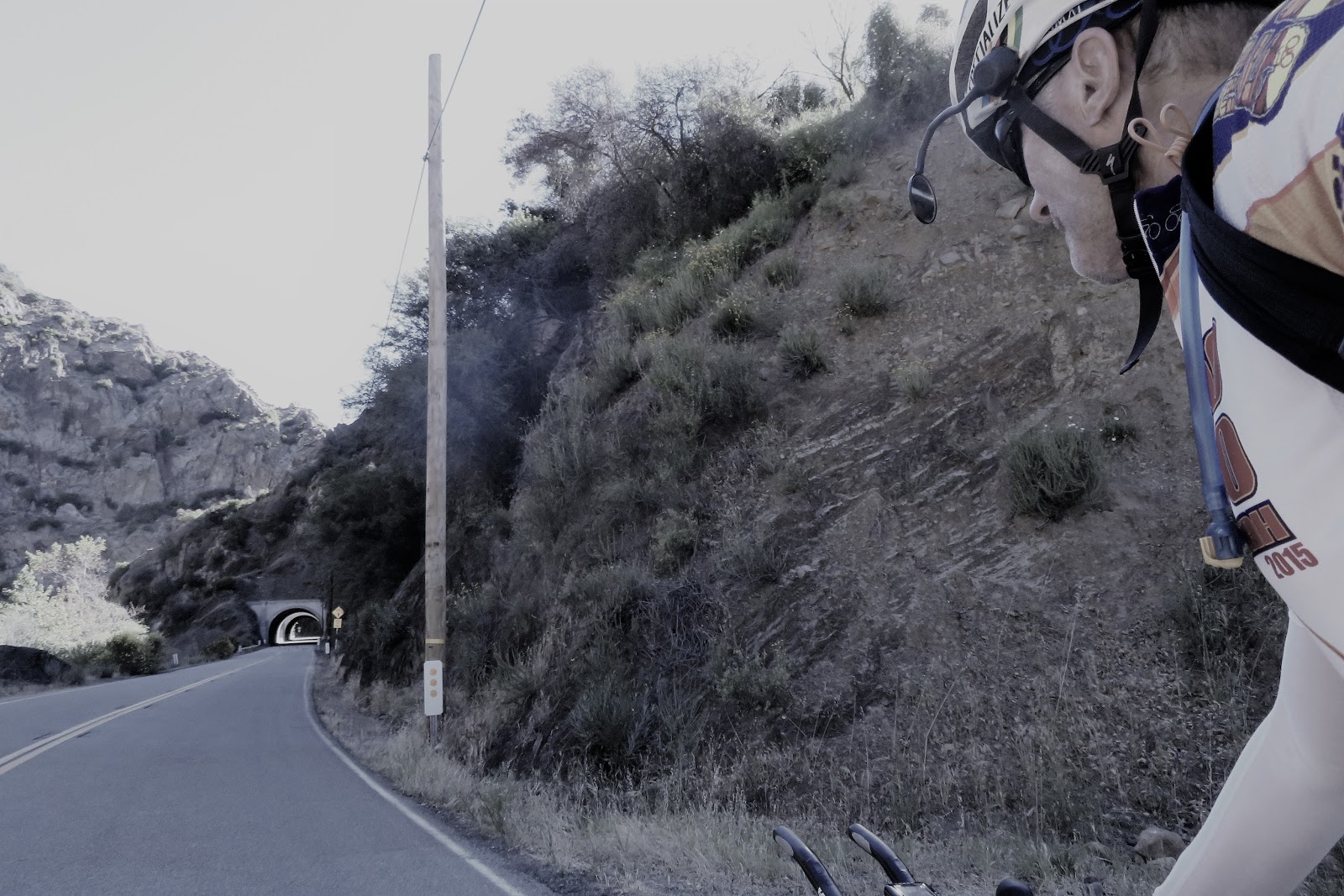
A few short tunnels on the way up


Tunnels
 The steepest part was from the lower slopes up till reaching the Wheeler Gorge campground.
I had a tailwind at this point. It was still pretty cool but with the tailwind, I was starting to get warm.
It is good that I started really early. Not sure how much hotter it would have been later in the morning.

I stopped for a short break at the campground.
A great place for a rest stop. Too bad they did not have any water here. Glad I planned accordingly.


You can see the road snaking up that mountain in the distance


This whole climb is a long slog, but oh so beautiful. The sweet broom plants were really fragrant all the way up to the summit. I felt really good the whole way up!!
I did get a bit overheated at one point and needed to stop for a break in the shade.
Almost to the summit. The climbing becomes pretty easy from here.
 I just cruised and enjoyed the view on the way up, taking many pictures along the way. This was the hardest climb of the day so I just wanted to enjoy it. It is also one of my favorite climbs of all time having done it countless times on TOTF (Tour of Two Forests), many of those on my tandem.
Summit of Wheeler Grade. Time to descend a bit to Sespe Gorge before turning around. 
I made it to the summit not too long after my stop at the campground and took a break to take some pictures. It was close to 10:30 am.

Below is a short video pan of the area.


I descended about halfway down into the Sespe Gorge before turning around and climbing back up. Once back up to the top, I took a food break.
 I used some leftover fajitas and rice to make some burritos for the ride. It was so good and refreshing.


  • Part 3: Summit to Ventura

The descent down was amazing. I was not able to maintain the speed I wanted because now there was a good headwind coming up the Gorge from the coast. Did this mean I was going to have a great tailwind heading back southbound? I certainly was hoping so!!

After I returned to the Ojai area, it was time to do Casitas Pass on Hwy 150 to Carpenteria. This is another wonderful climb with a very rewarding descent to the coast.
The first part of climbing this grade is very easy. The upper part is not too long but it is the steepest gradient of the whole ride at close to 10% at one point. I just paced myself.
Casitas Pass Summit

Then comes a great descent again into a headwind.

The last time I did this descent was on last falls, Dead of Winter Double Century. On that occasion, it was pouring rain and I was freezing. Glad it wasn't like that this time.

There is a method to my madness as far as my early start. I was hoping that according to the weather reports, I would get the usual tailwind on the next leg of my ride.

I made a left turn on Hwy 1 at the coast on to the bike path heading south. The winds were, unfortunately, out of the South,  for my cruise to Ventura before heading inland.

 They were not too strong but at this point, I was out of the water, and I could tell I was getting a bit dehydrated. I was feeling a slight bit of cramping coming on in my inner thigh. Not a good sign!!
Rolling past Rincon Point on the Hwy 1 bike path into a slight headwind.

I stopped at the drinking fountain at the Sea Cliff Fire Station and filled up my camel-back and two bottles with Tailwind Endurance Fuel. This has plenty of electrolytes in it and I was hoping I did not get too far behind on my hydration when it was cool out.


You really have to make sure you drink enough when it is cold too. Not drinking enough may be ok if it stays cool all day, but if it drastically goes from cool to hot rapidly, you may be in trouble. I was just hoping that I caught it on time. 


Heading toward the bike path leading into the town of Ventura


Brand new pavement on what used to be a very rough bike path

 I was so tempted to stop at Tony's Pizza in Ventura to get a slice but I used my will-power and kept going.


From Ventura, I headed back to the Santa Paula area via Foothill Road.

I started to get some pretty bad cramps in both legs, between Ventura and Santa Paula. I also had a really good tailwind starting to kick up as it got hotter inland.
I was now running out of food too, so I really could not push hard and take much advantage of it since I couldn't push on the pedals hard at this point. There were some pretty good kicker hills on Foothill Road for a while so this section was not as fun as it could have been.

I stopped in Santa Paula at an AM/PM for a sandwich, some salty chips, and a soda. I picked up a little bit more food for the road too, just in case.
I still had enough water to barely get me to Santa Clarita. They were out of bottled water at the store.

I ate half the sandwich and about half the salty chips. I guzzled down the soda and took off quickly.

The station had good social distancing protocols in place and I wore my mask into the store. There were not very many people inside so it was ok.

I now backtracked along the same course I had done in the morning and then continued East Bound past Grimes to the Piru area and then Santa Clarita.
Heading east on Guiberson Road


Heading east on Guiberson Road. 
Look at those giant cactus's!!


I started recovering nicely along this stretch. The tailwind helped, although, I still needed to be easy on the crampy legs and conserve my water.
Turning left on Torrey Road before connecting with Hwy 126. Tailwind kicking up really good now!!

When I made it to Torrey  Road and Hwy 126, the tailwind was really picking up nicely and it was cooling off some. This made a huge difference! I made it to the Magic Mountain area really fast and stopped at the fire station right after exiting the highway. I was totally out of water and they did not have water access like the Ventura County stations have. (Get with it LA!!!)

  • Final Leg: Santa Clarita to West Hills


That meant stopping at a store again. Arrggghhh!! I was now feeling so good that I could have made it all the way home picking up strength if I had water.

It was only a couple of miles to the next station with a store so there was not a problem. I now had a blazing hard tailwind coming out of the north that was blowing the huge flags straight south. What a great reward!!!!

As it cooled now.....I was feeling really strong and getting my legs back. I almost felt better than I had all day. Go figure.
Magic Mountain

I stopped at the Chevron Station store just past Magic Mountain on The Old Road. Again, the store was set up really well for the virus situation.
I got a large bottle of water and I guzzled a large coconut water. (the was really good)
I filled the two water bottles but not my pack. Two would get me home easy with this cool weather and tailwind. I finished the last half of my ham and cheese sandwich which I had purchased at the last stop in Santa Paula.

One more large bump to negotiate and I would be back in The Valley, Newhall Pass.
This was an easy climb but with so many miles in the legs, every climb seems hard.

I really surprised myself though. The climb over the pass seemed effortless. (Must have been the coconut water).
 I stopped at the top to check-in with home and take a few pictures. There was still plenty of light out and the wind was howling over the pass in just the right direction.
Newhall Pass looking south


Newhall Pass looking North
I rolled into a little bit of traffic down Balboa Blvd. to Rinaldi Street. Both with nice wide shoulders and bike lanes, it was an easy jaunt, traversing the Santa Susana Mountain foothills to get back to Chatsworth.
The sun was setting as I reached Chatsworth Lake.
I rolled around the lake and then did one final hill on Valley Circle before dropping to the house.

I made it in the door with just a little bit of light left.

What an epic day on the bike. A solo day to be with my thoughts and just enjoy the views.

I loved this ride!!
Valley Circle and Box Canyon Roads. Almost home. A couple short climbs to go and about 5 miles


Stats for my Heartbreak Course:


Virtual Eastern Sierra


Some of my fellow endurance riders asked me to join for their virtual course a couple weeks after my above Heartbreak course. We had nine people with a support vehicle to carry all our gear, food, and water. 
It was great fun with a group of very healthy riders who have been taking great care to stay healthy during these tough times. 
We did a course out of Malibu, Ca. that was very close to the highland Grand Tour course with some extra climbing so we would qualify for the Eastern Sierra (Virtual) which had to be close to the same elevation gain and mileage as the original event up in Bishop, Ca.

We started up the coast and turned on Encinal Canyon for a long climb up to the Decker Canyon fire station before dropping back down to PCH. We then went to Port Hueneme, Moorpark, Ventura, and Ojai. We did a large climbing loop out around Ojai before heading west for the climb over Casitas Pass to Carpenteria. It was then a long slog back south-bound to Malibu for the finish. 
We had perfect conditions. Cool and breezy all day, with a headwind in many places especially climbing out of Ojai. 
The final 60 or so miles we had a fantastic tailwind. It was one of the best tailwinds in recent memory. 
We finished before dark with a pretty good time overall.

A great day with friends on the bike.  A big huge thanks go out to Planet Ultra and the California Triple Crown, for allowing us to do the events we love so much and get credit for them. This was a great idea in this trying time.


A few pics from the day.


Heading north on PCH at first light.

Climbing the lower slopes of Encinal Canyon

Me and my shadow climbing Encinal Canyon


Robert Mann descending Encinal on his fixed gear.

Heading into Ventura County on PCH
Dee and I climbing Casitas Pass

Robert Mann climbing Casitas Pass on his fixed gear bike. 


Rincon Point

The new bike path heading in to Ventura

Rolling past Mugu Naval Air Station

Not far to go. Leaving point Mugu behind and heading toward Malibu. You can see point Mugu in the distance.


Thanks to Planet Ultra and The California Triple Crown for allowing us to keep doing these events during these troubling times, by developing this option. 
We endurance riders really appreciate having met our goals for finishing these events.


            Stats for my Eastern Sierra (Virtual) Course:


TOUR OF TWO FORESTS


It has been a few years since I have done TOTF. This year we had the option of doing it on a total virtual course as per the rules, or do the actual course out of Santa Clarita. (The actual course had a few modifications to bring the climbing and mileage down a slight bit per the "virtual" guidelines.) 

I opted to do the ride on the actual event day on the actual course. Since the start is so close to my house (about 21 miles), I decided to start from home like I did in 2015 when in training for Hoodoo Voyager division. 
It was a great training ride that year. The course simulates the arid climate and climbing of Hoodoo too. 
This year I am training for the Nomad division which is the 300-mile course. It will be my Hall of Fame ride so I am really excited about doing it. 

I started from home around 3:30 am so I could make sure I made it over Newhall Pass and into Santa Clarita before everyone started at 5. We had, as per the rules, a group of no more than 10 people. There were more than that doing the event, but everyone was broken into groups and had different SAG support.

We rolled slightly after 5 at a pretty brisk pace.

The course rolls through Santa Clarita along The Old Road which parallels Interstate 5 until you reach Hwy 126 which goes to Ventura before connecting with Hwy 101.

We were on the 126 for a few miles of very fast pace-line riding until we reached the town of Piru which is just below Lake Piru. 

We then followed the Santa Clara River all the way to Santa Paula.

It was then up to Ojai via Dennison Grade before connecting to Hwy 39, Maricopa Hwy.

The climb up Dennison Grade was not bad and pretty short. Temps were nice and cool.

Once we hit Hwy 39, the climbing got real. It is a long, long, climb up Wheeler Gorge before the first summit.
Now we had to drop into Sespe Gorge and start the long climb to the summit of Pine Mountain. 

This section just seemed to be endless.

We passed the section of the mountain that came down in the El Nino in the '90s. You can see where the mountain was gone. 
The course for TOTF was closed for many years which was the birth of The Heartbreak Double Century. (it was at first called TOTF but was changed later)

Once over Pine Mountain Summit, we had a long descent to Lockwood Valley Road where we had lunch before heading for Heartbreak Hill. 

It had been windy all day thus far. We now had a great tailwind for the climb. 

The wind was strong enough that it kept us cool on the normally very hot climb over Heartbreak, Lockwood, and Owls Barn summits.

It was then a blazing descent to Frazier Park and Lebec before heading back to Santa Clarita via Gorman, Hwy 138, and Elizabeth Lake Road.

We climbed and descended San Fracisquito Road to get back to the finish instead of Bouquet Canyon which is on the original course. 

We all had a great day and actually finished in daylight. Amazing!

Here are pictures of another epic ride. 

Tony on his fixed gear bike

Sunrise along the Santa Clara River

Shadows at sunrise

Margaret and Ron in Upper Ojai Valley

Margaret and Ron heading for the tunnels on Hwy 33.

Almost to the summit of Wheeler Gorge

The flowers were really fragrant on the Hwy 33 climb

Margaret smelling the flowers

The Summit above Ojai before dropping into Sespe Gorge.

The long climb out of Ojai

Margaret descending into a very windy Sespe Gorge

Water stop just before the final climb to the summit of Pine Mountain

Lunch

Lunch nap for Tony, in the sun

Two of the fixed gears. Tony and Rick on Lockwood Valley Road

The final climb on Heartbreak Hill

The final switch-back on Heartbreak hill. It still isn't over though. It still climbs pretty steeply from here.


Tony climbing Heartbreak on his Fixed Gear bike. Just craziness!!!


The final main climb

Summit of San Francisquito Road. A long descent awaits us.


Monday, March 23, 2020

Southern Inyo Double Century 2020, Spring edition.


This is one of my favorite places to ride. In the high desert, at the foot of the Southern Sierra Mountain Range.

The event is put on by Inyo Ultra and there are a number of different courses associated with The Southern Inyo Double.

This year for the spring event, it was offered once again as a Double-Double. This means that you can either do the main double century which is on Saturday or do the double-double which encompasses doing both events during the weekend.

They also have a moonlight double century during the summer which is run at night.

This springs event course started in Ridgecrest, Ca. right next to the sprawling,  China Lake Naval Air Station.
This is right near the epicenter of the 7+ magnitude earthquake in the area recently. I didn't see any sign of the damage there at all while there.

The first half was a ride out to Randsburg and Johannesburg before heading back to Ridgecrest via Trono Road and Hwy 178.
The second half took us north and up Hwy 395 to Olancha and back.

The second day, for the people doing the Double-Double, went up Hwy 395 to Hwy 190 in Olancha. Then they rode out to the Death Valley National  Park entrance sign before turning back. They then rode back to Hwy 395 via a loop around Owens Lake to Lone Pine before heading back to Ridgecrest. The second-day course is the same as the Southern Inyo by Moonlight Double Century.

I came into town on Friday morning and did a short 30-mile spin on some of the route prior to helping out with check-in Friday evening. I did the event on Saturday and I then got up early Sunday morning after day one to check-out the day two riders. It was really great to see everyone.

The base entrance across the street from the start hotel.

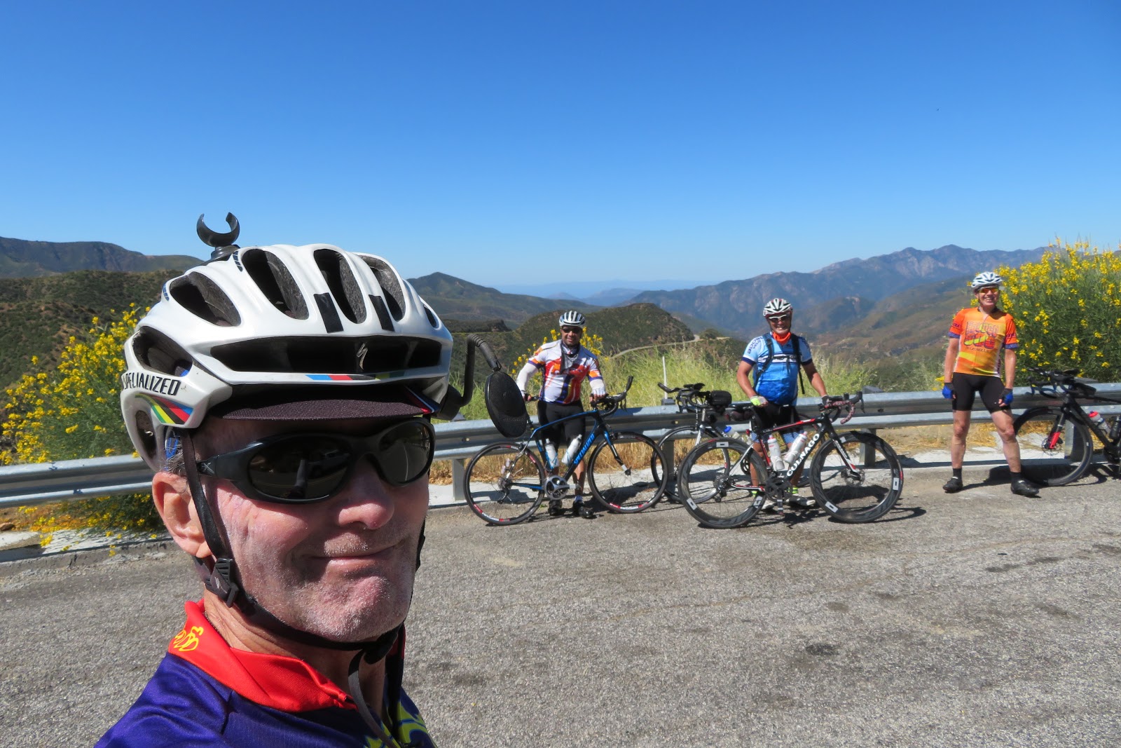
With my two good friends Tony and Kevin. Tony and Kevin were doing the Double-Double.
Tony on his fixed gear bike.
Tony did the 2018 Race across the West on his fixed gear.
He was the first-ever 60+ rider to complete that race on a fixed gear.
Kevin is an 11 time 508 Hall of Famer
.


2017 RAAM women's winner and 2016 RAW overall winner Sarah Cooper, came all the way from Iowa to do the event.

I saw many friends at check-in and during the ride. It was a great time the night before.
_________________________________________________________________________________


Start to mile 27.8


I started the day with a bunch of friends, as usual. We all rolled out at around 5am. It was still pretty dark out.
There were some groups who started as early as 4am.

I don't know what it is, but through all my training I have a nice even heart rate and I am able to really pace myself just right, to stay in a good steady rhythm with a good average pace over a long ride. 
Maybe my HR is elevated due to all the extra weight I am carrying in the pack on my back plus on the bike for long events. 
But as I have gotten older, on event days, I seem to start off with a much higher heart rate and it takes me quite some time to get my second wind before it settles into a good rhythm.

The same thing happened on this event again. I thought I was pacing myself well but then everyone started picking up the pace. My average HR was too high so I just backed off and let them go so I could maintain my normal pace. I still felt a bit off so I just cruised. (Over the whole day, I got stronger and stronger as the day went on. I could have easily done the second day judging by how I felt on Sunday after the first day.)

In Ridgecrest the day before the event, the temperature and wind conditions were just perfect. Not too cool with very little wind. On this day though, it was a different story. There was a storm moving in on the west coast and the winds were forecast to be 15-25 mph with gusts to 45. It was supposed to be much cooler too with cloud cover in the morning. 

The first section had a lot of climbing into a light crossing headwind for 8 miles to our turn on Brown Road in Inyokern. 

The Brown Road section was really nice. No cars, smooth road and a gradual climb to Hwy 395 on the way to the first checkpoint at just under 28 miles. The whole section was into a gradually increasing headwind though it wasn't too bad yet.
The roads were amazingly nice with hardly any traffic!!

I was starting to feel better although my HR was still higher than I would have liked it. I just rode steady and started passing a number of people, some that had started early and some that started at the same time as me but none of my group yet.

I got on Hwy 395 for a nice gradual climb to a summit into the wind before I hit the descent to the first checkpoint.
At this point, I decided to just keep going without stopping. I had plenty of food and it was so cold that I had not taken in that much of my fluid yet. I had plenty for the next section.

Heading toward Randsburg at sunrise

Heading toward Randsburg which is in those mountains in the distance.


Mile 27.8 to checkpoint 2, mile 63

I didn't see any of my friends at the checkpoint so they apparently didn't stop either.

This was the section that I really wanted to do. It has the Randburg Climb and Trona Road from the original Furnace Creek 508 bike race.

I crewed a few times at that race but never got to ride those areas and I was anxious to do it. 

There was a really nice descent to get down to the Randsburg climb but unfortunately, the wind was really getting strong now. It turned out to be a headwind the whole way down so it was impossible to get up any good speed or to relax and recover from the climbing prior to the rest stop.

I made the best of it and met a couple of guys from up north, one of whom was doing his first double century. 

I made the turn for Randsburg and took a break to strip off my jacket for the climb. 

The climb up to Randsburg is a long agonizing climb when it's hot but on this day I had a strong cold tailwind and the sun was just rising. It was a beautiful climb. I loved it. 
Randsburg mining town


I made it up to the town of Randsburg pretty fast and it seemed much easier than I anticipated. Even though my heart rate was somewhat high, I had no trouble breathing and had good power. I opted though, to just take it easy and go at a steady pace.

Randsburg is a neat old mining town with quite a history.  

I rolled through the old town but didn't take my usual pictures as it was so windy I didn't take my hands off the bars for fear I might lose control.

The next town we went through was Johannesburg on Hwy 395 before making the turn on Trona Road. 
Highway 395 rolling through Johannesburg. Next turn.....Trona Road.
Trona Road was my favorite road of the whole ride. This road has some amazing views and some epic hills. On the event this year, we now had a blazing tailwind of 25-30 mph. Wow....did that feel good. It made the climbs feel easy and made for great recovery on the descents. I really started to feel strong at this point in the ride once I got a little recovery from fighting climbs and wind together. 
Heading down Trona Road with an amazing tailwind.

My friends Steve, Gloria, and Ray on Trona Road. The views were just amazing.

I did stop at checkpoint 2 to fill my bottles and grab some food. The wind was really howling up there and I really have to hand it to the crew who were manning that stop. It felt brutally cold in that wind and I was exercising. I would have been freezing out there just standing around. For that reason, I made it a quick stop. 

Mile 63 to lunch. Mile 81

Less than 20 miles to lunch. I was happy because it had been tough on me to this point. I was feeling strong but still not myself. 

One little climb and then I had an unbelievable descent down to Hwy 178. The tailwind was so strong at this point that I could hardly slow the bike down. I was feathering the brakes much of the time worried about crosswinds and still was descending near or slightly above 50 mph.

After the turn on to Hwy 178, it really got tough. 

We now had a 25 mph crossing headwind, gusting to about 35 mph. I felt like I was riding my bike at a 45-degree angle leaning into that wind. A few of my friends actually got blown off the road into the dirt.

This is where I really started to get my second wind. (no pun intended). 

I put it in a bigger gear and just stayed at a steady pace, getting out of the saddle and grinding into it. It was also a gradual climb too so it was pretty tough.

I saw my friend Daniel in the distance so I used him as a carrot and just kept it steady until I caught up. He was suffering badly. The road was too narrow in the wind so it was too dangerous to ride alongside and talk. I just told him I would see him at lunch and forged ahead. 

 Once I got to the summit of that highway and could see Ridgecrest in the distance, it got a little easier. still windy but there was a slight descent so I could keep up a little bit of speed to get into town. 
Dropping back down heading west toward Ridgecrest and lunch. The Southern Sierra in the distance and the sprawling naval base to the right.

I made it to lunch way earlier than I anticipated so I felt good. When I got there between 10:30 and 11, I saw all my usual friends eating. They had not been there too long.

The lunch was amazing. It was supplied by my club, Adobo Velo. We had some amazing soup and pork bun as well as all the other usual stuff you have at a good lunch.


Lunch to Coso Junction. Mile 81 to 119

We rolled out of lunch with most of our morning group together.

Some who started with us in the morning did not stop for lunch or made a very short, stop.

We cruised west on Hwy 178 toward Inyokern once again into a crossing headwind but now it was much stronger than in the morning before sunrise.
My good friend Margaret.
She was riding really strong. Her coach has just done an amazing job with her training in the past few years. She has become an amazingly strong rider.
We pushed pretty well into it at a steady pace allowing our food to digest a bit before making our turn north at 8 miles from Ridgecrest.

Now we had a great reward.  TAILWINDS!!!

We made a quick stop to strip off some clothes because now we would not have the wind chill. It was still cool and in the '50s but much nicer with a tailwind.
Flying up Brown Road

We were looking for Gilligan and the castaways but couldn't find them.


Dee and Shelby flying up Brown road with the Sierra up ahead.

We flew up Brown Road to Hwy 395 at easily over a 20mph average speed.
Daniel turning on to Hwy 395 from Brown Road

Once we headed north, we started the climb to the high point on the ride. The elevation max was just above 4,000 feet elevation at the summit on 395 just north of Coso Junction our next stop. 

Even though most of this next section was uphill, we still moved at an incredible clip with the tailwind we had. It still doesn't mean it was much easier because you are tempted to still push hard even though you have a little help.

It was such a beautiful day now with some really beautiful cloud formations coming off the Southern Sierra mountains. This section was really nice but we were all cringing at the thought of the turn around in Olancha. I was praying that the strength of the southerly winds would die down some. We all didn't want to ride the final 50 or so miles into a 25-30 mph headwind. 


Highway 395 north
Ron, Robert, and Rick

Highway 395 north

We made it to the Coso Junction checkpoint really fast. The wind was really howling when we got there. We sat down, took a little break then headed up the road to the turn-around point in Olancha.


Coso Junction to Olancha. Mile 119 to 135.4

Leaving the checkpoint, we had a nice flat section with the tailwind until we started the climb up to the high point of the ride. It isn't a bad climb because we were already up at about 3,400 feet. 

Once over that little climb, we made it to the turn-around really fast and took a long break. 

Olancha is a neat little place. It is right near the cut-off for Death Valley via Hwy 190 and a great place to ride a bike. There is a great loop you can start either from Olancha or Lone Pine that takes you around Owens Lake past the little town of Keeler. One of my favorite sections of the original Southern Inyo Double course and part of the second-day course. The second-day course if doing the double-double is the same as the "Southern Inyo by Moonlight" double century held in the summer months.


Olancha Check-point. Hiding behind the gas station from the wind.


As I looked to the north from this check-point, I was thinking that it looked like the wind was blowing from another direction up there. It was just the way the dust from the Owens Lake looked. It didn't seem to be coming in a southerly direction. It seemed to be moving to the right while I looked north.

Could it be that we may have a wind switch to help us get back? I wasn't counting on it but who knows. 

Olancha to the final stop at Coso Junction. Mile 135.4 to mile 152

After stuffing our faces with food to try and put in some much needed calories for the fight against the wind, we headed out. 

Just about the whole way to Coso Junction we had a pretty bad head wind. 

We stayed in a pace line and took turns taking a pull at the front to give each of us a rest from the wind. It was a really good strategy.
I couldnt take any pictures during this stretch while in a paceline. Just too windy!!


Up to the point where we reached the high point of 4,000 feet before Coso, all we could maintain in a paceline was between 9-13 mph. The slower sections were where we had a hill on the course (which I think I got most of). We then had that nice descent down to the check-point and guess what.

WHEN WE GOT THERE THE WIND HAD ALMOST STOPPED AND WAS STARTING TO CHANGE TO A WESTERLY INSTEAD OF OUT OF THE SOUTH.

What a difference from when we were there just a few hours earlier.

My friend Quynh was manning the check-point and he had made some amazing soup for all of us. It was so good and it really helped top off our gas tanks.

Eating the amazing soup!!

Thanks, Quynh!!!


The final push. Coso Junction to the finish. Mile 152 to mile 190.

Now all of a sudden we were rolling at 15-17 mph with a crossing tailwind from our right. There were a few sections that has some really nasty crosswinds coming down the mountain passes that almost blew us down but all in all it was so much better than earlier in the day and a great way to finish the ride. 

I was actually starting now to finally get my rhythm going and I felt better than I had all day. I was getting cold though as the sun started to set behind the Sierra Range. 

Down we went, passing the town of Pearsonville. We have used this place as a starting point for our epic events up to Sherman Pass above Nine Mile Canyon and Kennedy Meadows.

We made the turn back on to Brown Road with a great tailwind now making it back to the turn in Inyokern pretty quickly, not really that much slower than we had on the way out with the really strong tailwind.
A little photo art.
Rick, rolling down Brown Road with China Lake in the distance.
My friend Rick ended up getting a flat tire not long after our turn on Brown Road. While waiting, I took a few pictures and then my friend Margaret and I started getting the chills and shakes from the cold so we started riding to warm up. 
Ron checking out the amazing sunset over the Sierra.

Such a beautiful afternoon.

Margaret and I ended up finishing together at around 6:30 PM with the rest of our little group pulling in not long after. 

It turned out to be a great ride but I could not imagine going back out and doing it again the next day unless the conditions were better. 
It turned out that the winds were not quite as bad on day two of the Double-Double but it was bone-chilling cold. They had temperatures below 32 degrees for about 4 hours in the morning with wind on top of that and an average temperature in the mid 30's for just about the whole morning. 
Yikes .....those are some tough people that finished the Double-Double.

A big thanks go out to Hugh Murphy and the crew at Inyo Ultra for another epic event.

 Hugh used to live for these types of rides and I guess he just wants to toughen all of us up. 

Thanks to George Chung and the whole Adobo Velo gang for the amazing lunch and post-ride dinner.

A big thanks go out to my posse who let this older guy hang with them. I hope I didn't slow you all down too much. LOL!!


Here is the link to ALL the pictures I took:   https://link.shutterfly.com/PW4ojFIZ54


Monday, December 9, 2019

6-12-24 Hour World Time Trial Championships 2019


The 6-12-24 Hour World Time Trial Championships put on by the Race Across America (RAAM) organization is one of the best-run events in the world. Great people, great venue location and perfect course for a long time trial.

Borrego Springs California is the location.

Borrego is an amazing place to visit any time but it’s especially nice in October/November when the event is held.

I did the 24-hour event in 2016 and then again in 2018. Last year I did the 24-hour solo division where I won my age group even after some pretty bad problems with my feet and my back. This was not my goal. It just happened.

2016 was on my tandem bike with my friend Teresa. We didn’t get quite as many miles done as we had planned due to physical problems but we still had a blast. Teresa did the 12-hour event in 2018 on the tandem event with our friend Richard. They set a course record in their division. 

This year I signed up to do the 2-person, mixed, 60+, 24-hour race with Teresa on our single bikes.

The event is 3 different races within one event.

The 24 hour time trial starts on a Friday evening at 5pm and then finishes on Saturday afternoon 24 hours later. The 12 hour time trial starts at 5am the next morning, 12 hours after the 24 hour and the 6 hour then starts 18 hours after the long race at 11am. All races ride the same course and finish at the same time.

The course is an 18-mile circuit with a pit area for support. The pit area is at the start/finish where the tracking device/lap counter is. 
For the 24 hour race, the idea is to get as many laps in as you can in 24 hours. At about 1.5 hours from the 5 pm finish, they put you on a short 4+ mile loop till finish time. That way racers will be able to be closer to the lap counter and get as many miles as possible and not be stranded out on the long loop, not making it to the finish in time. All racers must be done and through the Shute by 5pm.

Thursday

As I did last year, I left home early in the morning so I could get to Borrego pretty early in case I needed to pick up anything.

This year, again, Ultra-cyclist Marko Baloh was holding a meet and greet friendship ride on Thursday afternoon. I really wanted to make that again.

We all had a great time. Quite a few more people showed up this time. Some really fast people. 

I again saw my friends from Norway who I had met last year the day before the race, Monica and her husband who I will call Duke (I gave him that name because he owns Duke Sport bicycles in Norway. I had a hard time remembering his name so I asked if I could call him Duke. )

Below are a few pictures of the friendship ride.

RAAM veteran Marko Baloh

Rolling through the flats at a leisure 20mph


I was feeling pretty good on the friendship ride. 

That night at the hotel, I started to develop a toothache and it became severe overnight. Plus I started to get a fever because I had the chills so I was thinking I had an infection too. My team-mate Teresa was en route from home.
 I was seriously thinking of calling her and calling off the race. It was that bad. I took some pain killers along with a sleeping pill she gave me when she arrived and I think I slept some. It was so bad that I went to bed at 8pm. All I remember was pain all night. I was not sure if I slept some or not.


Friday

I felt a little better in the morning after we all went out to breakfast. 

At 11am I moved the van into the pit area to set up our pit for the race. While I did this, Teresa went out for a short spin around the course to check it out. She arrived in the pits when we started getting the bike inspections done.
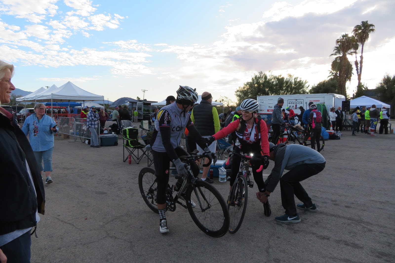
The pit is set up
We got checked-in, inspected and then we were ready to race. I set the van up with a small shade cover behind it for the time we had to wait before starting at 5pm. It was pretty warm but not as bad as last year.


Our friend Ron and his brother Howard, a two-man team, pitted next to us.


Our friend Ellen was a race official. Here she is inspecting Tigers bike.


4pm came around and it was time for the race meeting near the start. We were all ready to go so we just relaxed for a bit after the meeting.

We decided to switch-off every lap and I would go first at 5pm.  

The race is started in a number of "Waves", to keep things spread out. It is a "Non-drafting" race, so racers cannot follow in the rear of another rider unless they are passing.

We named our team, "TigerOwl" since that was our team name in 2016 when we did it on the tandem.

We started in the 3rd wave and I was on my way.

We did not miss a relay at the race and only lost 65 seconds doing the exchanges between riders. That means I only saw my team-mate for about a minute in the whole 24-hour race. We learned when we did RAAM,  from our crew-chief William,  just how much time you can lose during transitions from racer to racer so we really tried to keep it tight.

Teresa's boyfriend Chris was our crew. He did an amazing job taking care of us. He also helped others who were racing out there too when he had the chance. 

We started out the race, self-crewing ourselves for a couple hours while Chris drove out from work. He was following our progress on a phone app the whole time on his way out. He arrived at around 7pm.

As soon as the sun went down, I could tell we were going to be in for a cold night. It was really strange compared to the other 2 years we had done the event. 

In 2018 and 2016, I was able to get by with just a vest and knee warmers through the night. I never really got all that cold. This year was completely different. It seemed like there was a damp cold which is usually not the case in the desert. The prior 2 years it was in the low-50's or high-40's during the night and early morning. This year we had damp temps and in the mid-'30s. 

It was brutal and it really affected the times of most racers. Some actually called it quits due to the cold.

Then there was my infected tooth.

Throughout the night I fought that really bad toothache that was on and off. I also got extra cold and could feel that I had a fever because I just couldn't warm up, even sitting in the van with the heater on. I had the chills. 
I tried not to let on how bad I was feeling. I didn't want to bring everyone else down but I was not a happy camper. I kept telling myself that this 200 miles with a break every hour were going to be so much easier than when I did all my really long solo events. 
It was not. The conditions just made it feel harder.

Teresa on the other hand never said a negative thing the whole time, (although I only saw her for about a minute during the race. ) Every time I changed with her, she was upbeat!!

Our first couple of laps were pretty fast. My first was at about 20 mph. It went downhill for me as the night went on as far as my power and speed. The cold really affected me more and my lap times plummeted down to 3 laps that were in the low 16 mph range just before sunrise. I usually embrace the cold but not this time......argghhh!! 


Sunrise near Yaqui Pass Road. The temperature out on the cold part of the course was 35 degrees at this time.
Photo: Vic Armijo Photography


After the sun came up, we both started feeling much better. 
In fact, my lap times started to improve as the race went on during the day. 
Doing one of our transitions just after sunrise. It was still pretty cold.


Some fun in the pits. Our crew chief Chris


The temperature only reached the mid 80's which was perfect for the desert. In prior years we raced in temps that reached the low 100's during the day. 
If only I was feeling better through the night, we may have been able to win our division.

With about 4 hours to go, we had raised our average speed up to very close to our goal of 400 miles for 24 hours. Chris had been keeping good track of our progress and this really perked us up. 
Rolling late in the day on one of the final long laps.
Photo: Jen Magnuson Photography

We put the hammer down during this last part of the race. Many of my final laps were close to 18 mph which was getting us above the 16.6 mph average we would need to reach our goal.
Teresa was doing the same and cranking the final laps. 

When 3:30 came around, it was time for the short laps to come into play. 

Chris calculated that I would finish my final 18-mile circuit near 3:30. We discussed before I went out on the final long lap, that we would then have Teresa do 3 of the short laps to give me some recovery time from pushing really hard on the last long lap.

I kept a nice steady pace and was feeling much better on this final lap. I just didn't get it!!

Here it was, almost 24 hours in and the race almost over, and I was feeling so good. I surprisingly had my second fastest lap of the whole race on this final long circuit. Go figure.

I got back to the finish shute at right around 3:30 for the transition with Tiger.
 She hammered the next 3 short 4.7 mile laps averaging around 18.5 mph. She came on really strong at the end too.

I then went out to do as many laps as I could do before 5:03 pm which is 24 hours exactly from when our wave started. 


Making the turn on one of the final short laps.
 Photo: Vic Armijo Photography.

I got 2 great laps in and averaged about 19.2 mph. I rolled into the finish at just about 5 pm with not enough time for one more lap so we were done.

Wooooohooooo!! 

We were done and we got our goal. 402 miles for the 24 hours.

Thanks so much to Teresa and our awesome crew Chris Bergstrom. Chris did an outstanding job during the race, not only keeping us going but helping others wherever he could. Thanks so much, buddy!! Teresa was a rock star for the entire race.
Teresa (Tiger) Beck and I just as we finished the race. 


Left to right: Dee and husband Rob raced fixed gear, Rick raced fixed gear, Teresa and I, Ron and his brother Howard.


Thanks to everyone who came out to route us on.

A big shout out to Rick, Fred, Jeff, the crew at the RAAM organization and all the volunteers, for again putting on a stellar time trial event.

I know I have said it many times, but I really could not do this sort of thing without the support of my wife Ginny and my family. Thank you all for all your support and for putting up with my long training hours.

Link to all the pictures taken at the event: https://link.shutterfly.com/kO3CQN2Kc5


Summer and Fall 2025

  After getting through my back surgery ordeal and finally doing my 200th double century back in June, I decided to round out the year with ...